CALLING ALL A1A EXPLORERS…
Welcome to the Explorers’ Circle, our virtual basecamp journal for sharing A1A discoveries, stories, and pics!
We’ve divided this journal area into four (4) regional sections (North, Central, South, and the Keys) then listed the destinations within each section in alphabetical order. As we continue to explore additional locations, we’ll be adding those discoveries here too. And, if you have a new or vintage A1A inspired pic or story you’d like to share, share it here and let the growing community of kindred spirits find yet another reason to get out and explore A1A!
NORTH (Begins in Fernandina Beach/Amelia Island)
AMELIA ISLAND: Who doesn’t love a good pirate story, right? According to AmeliaIsland.com, during a period that lasted more than 200 years, Amelia Island was home to the largest concentration of pirates in America and naming just a few of the notorious would include Blackbeard, the brothers Jean & Pierre Lafitte, “Calico Jack” Rackham, Irish born Anne McCormac Bonny, and Luis Aury. Whether there is still treasure to be found on the island is a subject of constant debate and a theme in many ghost stories. This pic was taken at Amelia Island State Park, today the park protects more than 200 acres of unspoiled wilderness along the southern tip of Amelia Island and it’s the only Florida State Park that offers horseback riding on its beaches. If you decide to come here and explore or do some treasure hunting of your own, the address for the park is State Road A1A North, 32226.
AMERICAN BEACH: NANA, the tallest dune in Florida is on American Beach, Amelia Island. This protected landmark is largely due to the efforts of MaVynne Betsch (1935-2005) widely known as the “Beach Lady” and who is lovingly remembered for her mantra, “Getting the most from the least and living peacefully in harmony with nature is the most rewarding lifestyle.” If you decide to come and explore this magnificent area, here’s a GPS address you can use to get you to the American Beach Community Center -1600 Julia Street, Fernandina Beach, 32034.
AMERICAN BEACH: From documentary filmmaker Kathleen Donaghy’s site (AnAmericanBeach.com) we learned that Abraham Lincoln Lewis (known as A.L. Lewis) was born in Madison Florida in 1865. He was the son of a blacksmith who had been a slave on one of the many plantations in Madison County and neither his parents nor older siblings could read or write. Yet by 1901, Lewis was one of the seven founders of the Afro-American Life Insurance Company, the first insurance company in the state of Florida, Black or White, and became the state’s first Black millionaire, as well as one of the wealthiest men in the Southeast. In 1935, Lewis bought oceanfront property on Amelia Island and established American Beach which became a vacation mecca for blacks through the 1930s, 40s and 50s and which later earned the distinction of National Historic Landmark. This pic was shot on historic American Beach and if you want to come and explore this extraordinary area, make your way to 1556 Gregg St., 32034.

BEVERLY BEACH: In the 1920’s a scenic highway from Ocean City (now Flagler Beach) to Mosquito Inlet (now Ponce de Leon Inlet) was pretty much of a dream until Claude Grady Varn, through vision and influence, furthered the construction of Oceanshore Boulevard/A1A opening up 40+ miles of ocean frontage from St. Augustine to Daytona Beach. This is a pic of a sunrise over Beverly Beach (a town founded by Mr. Varn); the air temperature was about 40 degrees cooler than the water temperature turning the ocean into an Atlantic-sized hot tub. The “main street” here is a gorgeous one-mile stretch of highway A1A running between the Atlantic Ocean and the Intracoastal Waterway on a .25-mile wide barrier island and if you decide to come here and explore it, the address to the Town Hall is 2735 N. Oceanshore Blvd., Beverly Beach, 32136.
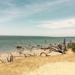
BIG TALBOT ISLAND: Spoiler Alert: the following is a “Debbie Downer” story so please don’t read on if that might ruin your day… Today Big Talbot Island is primarily a natural preserve and from several sources we learned that the earliest evidence of human activity/occupation in this area can be dated back to 4000 B.C. Known to scholars as the Archaic people, their culture existed some 5500 years before the first Europeans arrived and named these inhabitants, the Timucua. Now considered an extinct population (primarily due to European diseases and warfare); by the time the US acquired Florida in 1821, it’s tragically estimated only a handful of the Timucuan people still lived. This pic seemed fitting for the story and is of Boneyard Beach on Big Talbot Island, famous for the salt-washed skeletons of live oak and cedar trees that once grew near the shore. This State Park is open year-round from 8 am to sunset and if you decide to come here and explore, the address is 12157 Heckscher Dr., Jacksonville 32226.
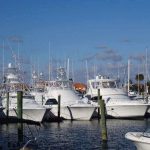
CAMACHEE ISLAND: On A1A just across the bridge from Vilano Beach and about two miles north of St. Augustine’s Historic District, we noticed a marker that read Camachee Island so we decided to explore it. There we found a couple of places to eat, boat rentals, sailing, a boater’s store, about a dozen or so shops, a marina, and a waterfront hotel called The Inn at Camachee Harbor. The marina is adjacent to the Intracoastal Waterway and about a mile from St. Augustine Inlet and the Atlantic Ocean and according to their website CamacheeIsland.com has 260 slips for boats of all sizes. We snapped this pic from the Camachee Yacht Yard and if you decide to come here and explore, make your way to 3020 Harbor Dr., 32092.
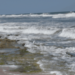
CRESCENT BEACH: We pulled this sea monster of a story from the Smithsonian Institution Archives (siarchives.si.edu). Measuring 18 feet long, 10 feet wide, and weighing more than 5 tons, the carcass of the “St. Augustine Monster” was discovered by two young boys on Anastasia Island in November, 1896 who at the time, reported their findings as a whale. The following year however, it was concluded by the founder of the St. Augustine Historical Society and Institute of Science to be the remains of a giant octopus. Debate continued at varying levels of interest and testing for more than a century until the 2004 DNA tests applied to the St. Augustine sample along with other monster remnants from around the world identified all as the collagen matrix that holds together… wait for it… whale blubber. And while it’s unlikely you’ll find any sea monsters on Anastasia Island today, you will find spectacular Crescent Beach where this pic was taken and if you decide to come here and explore, here’s the address – 6930 A1A South, 32080.
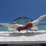
DAYTONA BEACH: The Red Diving Girl made her first appearance in the Jantzen swimwear catalog in 1920, soon after, decals of her image appeared on cars and windshields across the country and by the end of the decade her image became an international symbol; because the image is still part of the Jantzen logo, it’s one of the longest-lived apparel icons in advertising history. Interestingly, we found that in 1924 the registrar of motor vehicles in Boston determined that the silhouette of a bathing girl was too distracting and banned the decals from cars in “the interest of safety”. As the legend goes, in 1959 a mannequin company transformed the iconic logo into a 19.5 foot fiberglass figure to be used in advertising; only 6 of these figures were ever made. One of the six made her way to Miami then in 1965, made her way from Miami to the “World’s Most Famous Beach” where she’s been maintaining perfect form ever since. If you decide to visit her, you’ll find her “hanging” out at 8 N Ocean Ave, Daytona Beach, 32118.
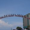
DAYTONA BEACH: From James Lilliefors’ book titled “America’s Boardwalks from Coney Island to California” we learned that at the first meet in 1903, a car owned by auto-maker Olds set an American speed record at 54.38 mph. The success of the 1903 time trials launched a tradition which drew car manufacturers and enthusiasts from around the world to Florida’s Atlantic coast where the sand and coquina shell beaches at Daytona and Ormond became a showcase for the world’s fastest cars drawing hundreds of spectators who lined the beaches for a chance to witness a world record run. By the late 1920s, as the engines became bigger, cars became faster, and records routinely fell, the time trials swelled in popularity and earned Daytona Beach an international reputation as “The World’s Most Famous Beach”. A title, as evidenced by this pic, that has stuck to Daytona Beach for nearly 100 years. And if you want to snap a pic here too, make your way to the corner of E Int’l Speedway Blvd. & Atlantic Ave., 32118.
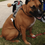
DAYTONA BEACH: How about one from HauntedPlaces.org? In Daytona Beach one day in 1940, a little brown dog romped into a Beach Street cab company and history was made. The cabbies built him a dog house and “Brownie” as they called him, slept in the house at night and wandered around Beach Street during the day. Soon he became a local celebrity and donations flooded in from all over the country to help cover his costs. When Brownie died in 1954 he was buried in Riverfront Park with more than 70 people in attendance including the mayor who delivered the eulogy. On Brownie’s grave stone is an etching of him with the words “THE TOWN DOG and A GOOD DOG below”. Over the years the stone was lost to overgrowth and all but forgotten but when the park was undergoing renovations in the early 1990s it was uncovered and a small topiary in the shape of a dog was planted next to it. In 2007 there was even a Brownie Festival, complete with a Brownie look-alike contest. Of course not everyone thinks Brownie is truly gone – a few folks claim they’ve seen and felt Brownie’s presence in the area near his Riverfront Park grave site; here are the GPS coordinates if you decide to check it out (29.208930630204552, -81.01710900664335). With apologies to Brownie and Daytona Beach, we shot this pic in Jax Beach at last year’s costumed dog parade and thought it made a spooky fun addition to this story!
FERNANDINA BEACH: The Palace Saloon in Fernandina Beach has earned the title of “Florida’s oldest” continuously operated drinking establishment. According to local lore, it was the last bar in Florida to close on the eve of Prohibition, selling spirits until midnight and grossing $60,000 in a single day (just for a little perspective that’s about $750,000 in today’s dollars). The Palace survived the Prohibition years by selling gasoline, ice cream, and a variety of adult beverages including special wines, 3 percent near-beer, and the owner’s signature Cumberland whiskey (what Prohibition?). Regardless of your beverage of choice, stop in to see this historic pre-Prohibition bar’s mosaic floors, fabulous tin ceiling, and painted murals. This is a pic of one of the wall murals you’ll find here and if you decide to check it out, the address is 117 Centre Street, Fernandina Beach, 32034.
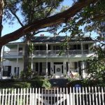
FERNANDINA BEACH: While strolling down historic Centre Street in Fernandina Beach we came across a Florida Heritage Site marker that read, “THE LESESNE HOUSE This Classical Revival style residence, built by Dr. John F. Lesesne is one of the oldest homes in Fernandina Beach. Dr. Lesesne left Fernandina during the Civil War and did not return. In 1868 the house became the property of the family of Judge John Friend who had been appointed district tax commissioner after the war by President Andrew Johnson. Friend was a lawyer and served as a county commissioner and judge. At the time of this death in 1878 he was state senator-elect from Nassau County. The descendants of the Friend family still occupy the home. This double galleried home constructed of hand-hewn lumber fastened with wooden pegs is one of the major points of interest in the Fernandina Beach Historic District which was listed in the National Register of Historic Places in 1973.” We shot this pic in front of the super-cool historic home and if you decide to make your way here too, head to 415 Centre Street, Fernandina Beach, 32034.
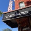
FERNANDINA BEACH: Ready for a haunt? This one from Waymarking.com is about The Palace Saloon, Florida’s oldest continually operated drinking establishment. Between 1880-1910 the Fernandina docks were among the busiest in the south and in its prime, welcomed ships from every corner of the world. Of the many saloons that lined the lively streets of Fernandina’s harbor district – and there were over 20 at the time – only one had the distinction of being the “Ship Captains’ Bar” and that was The Palace Saloon. While the ghosts of a Rockefeller and a Carnegie are rumored to be among these who linger here too, it’s the spirit of Uncle Charlie that is believed to be most active. Bartender Charlie Beresford, who worked at the saloon from 1906 to 1960 became known to patrons as “Uncle Charlie”. Legend has it Charlie would bet patrons they couldn’t throw coins and have them land (and stay) on the busts of statues behind the bar. Needless to say, at the end of each night he’d scoop up quite a bit of change. After he died, another bartender made the same bet with patrons and felt a hand on his shoulder as though he were being told to stop. Charlie’s spirit has also purportedly played a tune or two on the piano even though its keys were encased in plexiglass and although Uncle Charlie passed away in 1960, some maintain he never actually left. We shot this pic of the legendary Palace Saloon and if you decide to come here and try to make contact with Uncle Charlie for yourself, head to Fernandina Beach on Amelia Island and make your way to 117 Centre St., 32034.
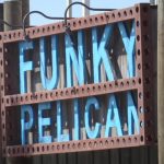
FLAGLER BEACH: From multiple sources we learned that until 1925, the fantastic seaside community we now know as Flagler Beach was called Ocean City Beach. In 1909, Isaac I. Moody, Jr. and Major James Frank Lambert purchased 30,000 acres of land from Georgia Senator George Deen. Moody, who envisioned a beach resort, began subdividing 169 acres of their “Ocean City Beach” property located east of the Intracoastal Waterway. He built the first beach house here in 1914 followed by the Ocean City Beach Casino but when it came time to apply for a postal permit for the area, they were told that since there was already an Ocean City, NJ and an Ocean City, MD another Ocean City would not be accepted. So in 1925 the city was instead incorporated as Flagler Beach, in honor of Henry Flagler. This pic was taken at the Funky Pelican, a relaxed ocean-side dining and beach bar with spectacular views and while there are several terrific options along A1A here (The Golden Lion Cafe, Flagler Beachfront Winery), this is one of only a couple of options where the only thing between you and the ocean, is sand. Here’s the address if you decide to make your way here to explore, 215 Hwy A1A, 32136.
FLAGLER BEACH: One of our favorite scenic stretches of A1A can be found running through the funky-cool coastal community of Flagler Beach where explorers are treated to spectacular and unobstructed views of the Atlantic. The central gathering area here is the Municipal Boardwalk and Pier and from this location, you’ll find restaurants and shops to the north, south, and west, miles of stunning beaches, and for families with special needs, there’s also a beach wheelchair available at the Pier’s Bait House that can be used free of charge. Flagler County is also home to more than 20 county parks and preserves. Five of the parks have been designated as part of the Great Florida Birding Trail where bird watchers come from all over to see roughly 500 verified species one of which is captured here in this pic shot from the rooftop deck at Flagler Beach’s Golden Lion Café and if you decide to come here and enjoy the view, make your way to 501 N. Oceanshore Blvd./A1A, 32136.
FORT GEORGE INLET: Unlike the mud bottom of the surrounding area, the bottom of the Fort George Inlet area is all sand and on an incoming tide, the water is fantastically clear here. This is a pic of the sand bar at Fort George Inlet and although its size makes it seem like more of an island, it still qualifies as a sand bar because it shifts/moves throughout the year. Although the Inlet is not navigable to the ocean (sand bars & a fixed bridge) if you’re coming by boat, you can reach the Inlet from the Intracoastal and on any given weekend you’ll likely find dozens of boats lining this popular spot. If you’re coming by land, access to the Inlet (as well as the ocean) is available through Huguenot Memorial Park, 10980 Heckscher Dr/A1A, 32226. Early bird entry to the park is $3 per vehicle.
FORT MATANZAS: The history of Fort Matanzas National Monument begins with an incident almost 200 years before the construction of the fort; the Spanish massacres of French forces in 1565. The incidents initiated Spanish control of Florida for 235 years and led to the naming of the Matanzas (which means ‘slaughters’ in Spanish) Inlet & River. This pic of the Matanzas River was shot from A1A near the fort. There’s no charge to tour the fort nor to take the ferry over/back but you do need a boarding pass which is issued at the Visitor Center. If you decide to come here and explore, the address is 8635 A1A South, 32080.
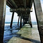
JACKSONVILLE BEACH: The pic on the right was taken under Jacksonville Beach Fishing Pier and the pic on the left featuring our friend Wesley, is intended to share a bit of a visual perspective just how far out the pier actually extends. Reaching more than 1000 feet off shore, for $1 admission (kids under 6 are free) we get to experience some truly magnificent Atlantic views. The address for the Pier is 503 1st St N, 32250.
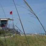
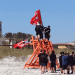 JACKSONVILLE BEACH: For more than 100 years the men and women of the American Red Cross Volunteer Life Saving Corps have stood watch over Jacksonville’s beaches. Founded in 1911/12, the Life Saving Corps was originally set up in Pablo Beach which later, in 1925, became Jacksonville Beach. In 1993, the Corps began accepting women candidates into the program. Today, new recruits undergo an intense training program that includes first aid, CPR, ocean rescue, and training on weather conditions and to be considered, candidates must be 16 years old by the completion of the session. This training session pic was shot in front of the iconic life guard station located at 2 Ocean Front N, 32250 and if you decide to come here and explore, please consider donating generously to help the Volunteer Corps continue to fulfill its mission of saving lives.
JACKSONVILLE BEACH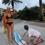 :From Copper.org we learned that since 1968, artist J. Seward Johnson, Jr., has been blurring the line between art and reality with his surreal bronze sculptures that stunningly capture the everyday. Created with candid accuracy and meticulous detail, Johnson’s sculptures are so much like the real thing, passersby often do a double take. Heir to the Johnson & Johnson empire, Johnson carved a niche path in life creating his own legacy along the way. This is a pic of Johnson’s work titled “Dawn Patrol,” that consists of a set of life-size, hand-painted bronze sculptures. The woman is carrying a longboard and smiling excitedly while peering to the east. The man is waxing his surfboard while happily looking up at her. The work was donated to the city by the artist’s sister Jennifer Johnson Duke; a gift to the City of Jacksonville Beach in 2009 where it is on permanent public display in Latham Plaza. If you decide to come here and do a double take for yourself, head toward the corner of 1st Ave. N & 2nd St. N near Zeta Brewing and the rear entrance to City Hall, 32250.
 LITTLE TALBOT ISLAND: From StateParks.com we learned that Little Talbot Island has more than five miles of beautiful, white sandy beaches and is one of the few remaining undeveloped barrier islands in Northeast Florida. Maritime forests, desert-like dunes, and undisturbed salt marshes on the western side of the island allow hours of nature study and relaxation and where you’ll likely find river otters, marsh rabbits, bobcats, and a variety of native and migrating birds. Archaeologists have found evidence of Timucuan villages in this area dating back over 5000 years. The Timucuan people lived a relatively peaceful existence until the French and Spanish arrived in the 1500’s. By the 1800’s, the entire Timucuan population was virtually non-existent. The island was named by English General James Oglethorpe for Lord Baron Talbot and was ultimately acquired by the state of Florida in 1951 and opened as a park in 1952. Florida state parks are open from 8 a.m. until sundown 365 days a year and if you decide to come here and explore this stunningly beautiful area, head to 12157 Heckscher Dr., 32226.
 MARINELAND: Through “The Images of America” series, authors Cheryl Messinger and Terran McGinnis chronicle the colorful history of Marineland and how it got its name. In the Summer of 1938, tourist attraction Marine Studios opened on a relatively uninhabited parcel of land directly on A1A where for a fee of $1.10, visitors were transported into a unique undersea world to witness sea life as it had never been seen before. By the 1940s, Marine Studios was Florida’s largest tourist attraction and so popular was the draw that the land adjacent to the attraction became the town of Marineland. The name of the town became synonymous with the tourist attraction and as the authors describe as a classic turn of events, in 1961 Marine Studios officially changed its name to Marineland of Florida. This pic was taken on Marineland’s spectacular beach and if you decide to come here and explore the area, head to the parking lot just south of the facility (near 9700 N Oceanshore Blvd., 32080) where there’s plenty of free parking.
MAYPORT: Inhabited by the Timucuan Indians for more than 5,000 years, historic Mayport Village was settled by French Huguenots some 450 years ago. Because Mayport sits at the mouth of the Saint Johns River, it also became the stalking grounds for many of histories history’s notorious pirates, buccaneers, and other opposing naval forces, right up to the American Civil War. Needless to say, with its colorful (and violent) past it’s believed a significant spiritual residue has been left behind in Mayport including this pic of the King House (said to be one of the most haunted houses in Florida), the “Lady in White”, phantom ships, or sightings of a ghostly sailor wearing a khaki uniform, Mayport might be the perfect spot for an October road trip. If you come, the only public road to Mayport is our all-time favorite SR A1A, which crosses the St. Johns River via Ferry (there’s a small fee) and makes an extraordinary way to enter or exit the area. If you decided to come here and explore, the address is 4627 Ocean Street, Mayport, 32233.
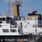 MAYPORT: Established on August 16, 2005 the Jacksonville Sector of the United States Coast Guard is located along the St. Johns River in Mayport on six acres of land adjacent to the Naval Station. From uscg.mil we learned that the Jacksonville Sector is responsible for 40,000 square miles of ocean and inland waterways including 190 miles of coastline, 10 inlets, 248 miles of the Intracoastal Waterway, 161 miles of the St. John’s River, and numerous rivers, creeks, and marshes. To cover this diverse and challenging area, Sector Jacksonville utilizes Multi-Mission Station Mayport, Station Ponce de Leon Inlet, and Station Port Canaveral and magnificent vessels like the one pictured here. This pic was shot from A1A in Mayport and if you decide to come here and explore, make your way toward 4200 Ocean St., 32233.
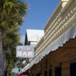 NEPTUNE BEACH: Here’s one for all the John Grisham fans… In his book The Brethren, Grisham’s character Trevor not only mentions this Neptune Beach landmark by name, but the author (in a story we found by First Coast News) was said to have actually written part of the novel in the bar. Pete’s Bar has been operated by the same family for more than 80 years and in 1933 when prohibition ended, was allegedly the first business in Duval County to receive a liquor license. The drinks here are strong and you can still shoot a game of pool for .25¢ but be warned; if you have the slightest aversion to smoked-filled rooms, you may not last long enough inside this landmark to finish ordering. If you decide to check it out, the address is 117 1st St, Neptune Beach, 32266.
 NEPTUNE BEACH: is comprised of approximately 2.5 square miles that’s bordered by the City of Atlantic Beach to the north and the City of Jacksonville Beach to the south. According to HistoicalTextArchive.com, in 1922 Dan G. Wheeler, Sr. had a cottage on the ocean front near where One Ocean Resort & Spa is today. Wheeler was manager of Smith, Richardson & Conroy “Fresh Meats and Provisions” in Jacksonville and he and his family spent summers at the beach. To get to work in Jacksonville, he had to walk almost to Mayport to catch the train. Told that the train would only stop at a station, he built one and called it Neptune. The area remained a part of Jacksonville Beach until the tax revolt of 1931, when on August 11, the residents of Neptune voted 113 to 31 to secede from Jacksonville Beach and incorporate as the City of Neptune Beach. And while this story seems to be the generally accepted version of the origins of Neptune Beach, we should note we found reference to an undated Atlantic Beach Corporation map that refers to Neptune that may have been drawn as early as 1917 and a Chamber of Commerce report listing a plat titled, “Plan of Town of Neptune Beach” recorded as early as 1902. We shot this pic on stunning Neptune Beach near the Lemon Bar and if you decide to come here and explore, head toward 120 Atlantic Blvd., 32266.
ORMOND BEACH: Named for the hand-cut casement windows that adorn the mansion and nicknamed “The Jewel of Ormond Beach”, The Casements was the winter home (think epic Holiday parties) of billionaire John D. Rockefeller, Sr. from 1918 until his death at age 97. Years later, unoccupied and deteriorated, the home was placed on the National Register of Historic Places in 1972 and purchased by the City of Ormond Beach the following year. With the assistance of a grant, the restoration was completed in 1979. Now this multi-use facility and manicured gardens on the bank of the Halifax River provides the historic setting for classes, workshops, rentals, special events, and tours. If you decide to check it out, the address is 25 Riverside Dr, Ormond Beach,32176.
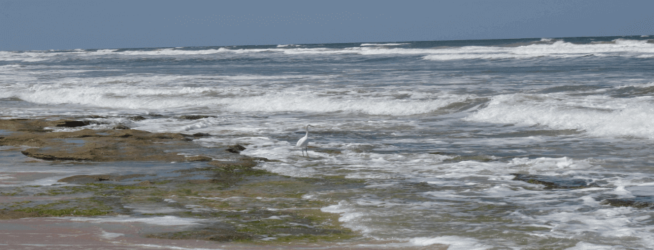
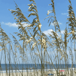
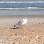
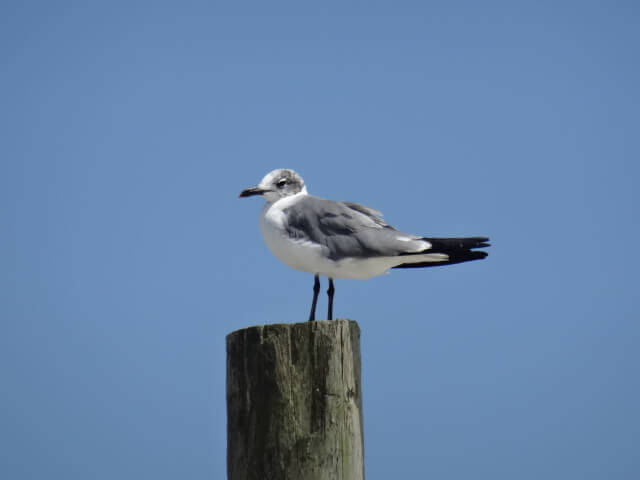 ORMOND BEACH: Have you ever just zoned out on the beach watching birds and thought, “I wonder how many different kinds of birds there are?” Us too and according to FloridasNature.com website, Florida is home to more than 500 species of birds and has more species than any other state east of the Mississippi River making it one of the top bird watching destinations in the world. The Great Florida Birding Trail (floridabirdingtrail.com) a project of the Florida Fish and Wildlife Conservation Commission, was completed in 2006 and offers fantastic birding resources including a highway-connected string of individual birding sites located throughout the entire state, roughly 50 sites are designated along A1A. This pic was taken on spectacular Ormond Beach and although we spent close to an hour trying to figure out what type of gull (?) this is, we’re not sure we ever did. So, if you happen to know please tell us and end our torment! UPDATE: With thanks and gratitude to Instagramers @raisingfloridaboys and @dg_nash for confirming this pic is of a Laughing Gull; mystery solved!
 ORMOND BEACH: In the mood for a few stories this month about A1A haunts? So are we… Our first tale is from Ormond Beach and from HauntedPlaces.org we learned about something called the Tomoka Lights. According to the tale, if you drive north on Beach Street in Ormond Beach late at night, toward Tomoka State Park, you just might run into the Tomoka Lights (also known as the Ormond Lights). These are typical “ghost lights” – balls of light that appear out of nowhere, and sometimes seem to follow cars around. On the site, users can weigh in on whether they think a place is really haunted and based on the people who responded, 91% believe that it is. If you decide to come here and explore, here are the GPS coordinates shared on the website: 29.334871093000825, -81.08085853803709. Be careful though, several people have reported having car accidents and near misses in this area while searching for the lights. We shot this pic on fantabulous Ormond Beach and if you tilt the image to the left a bit, we’re pretty sure you’ll see a ghost sitting in that chair – not really though; we made up the part about the ghost.
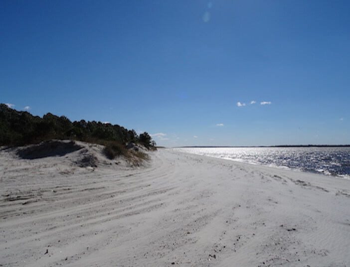
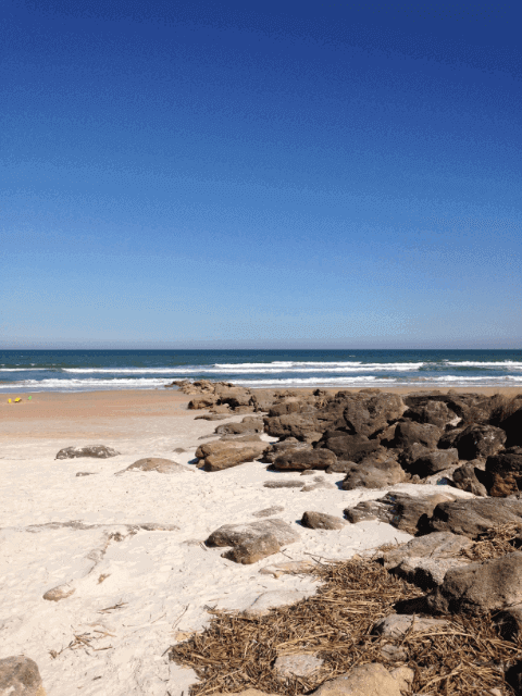
 ORMOND BY THE SEA: Just north of Ormond Beach, south of the Volusia/Flagler county line and nestled between the Atlantic Ocean and the Halifax River is a post-card perfect stretch along A1A called Ormond By The Sea. Although the overall land area here is only about 2 square miles, it supports at least six distinct ecological zones. This is a pic of the beach or tidal zone, featuring a distinctive reddish-colored sand created by crushed coquina shells. If you decide to make your way here and explore, here’s an address that will bring you to the center of town – 1800 N Oceanshore Blvd, 32176.
PALM COAST: From the City of Palm Coast’s website we learned that prior to 1969, the land that eventually became the City of Palm Coast was considered by some as “a big pine-covered swamp.” Today, Palm Coast has more than 75,000 residents, 13 beautiful parks, 125+ miles of connecting trails and paths for walking/bicycling, a year-round Running Series, world-class tennis and golf, and pristine beaches. This pic was taken at the extraordinary Washington Oaks Gardens State Park which straddles our favorite highway A1A. On the west side of the highway you’ll find the park entrance and stunning formal gardens; on the east side, you’ll find a unique shoreline of coquina rock formation that lines the Atlantic. If you decide to come here and explore, the address is 6400 N Oceanshore Blvd, 32137.
 PALM COAST/WASHINGTON OAKS GARDENS STATE PARK: Extraordinary is the word we would use to describe Washington Oaks Gardens State Park and we found the perfect description of the area on FloridaStateParks.org – “A place where an unexpected combination of unique features unites to create unanticipated beauty. It is located on a barrier island and contains remarkable natural spaces with the Atlantic Ocean to the east and the Matanzas River to the west. Because of its beautiful coquina rock formations, the beachside of the park is not for swimming, it’s for exploring. Low tide is the best time to investigate the secret world of the tidal pools enclosed in the ancient coquina. The river side of the park offers beautiful views of the Matanzas river and the nature preserves beyond. The middle of the park is no less beautiful; it is dominated by a live oak hammock with majestic, 200 year-old trees covered in Spanish moss. Within this hammock lies the heart of the park, a twenty-acre botanical garden.” We shot this pic while exploring beachside and if you decide to make your way here too, be sure to check in at the Ranger’s station before heading over to this side of the park as the parking lot here is monitored and you need to display your admission receipt on your vehicle’s dash. Here’s the address – 6400 N. Oceanshore Blvd., Palm Coast, 32137.
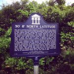
PONTE VEDRA BEACH: At a position of 30 degrees 8 minutes north latitude (between St. Augustine and Ponte Vedra Beach) you’ll find a historical marker recognizing the only navigational reading recorded of Ponce de Leon’s “Journey of Discovery” taken the day before his April 3, 1513 landing when he claimed La Florida for Spain. If you want to want to check it out and don’t have a quadrant or mariner’s astrolabe handy, make your way to the North Beach Access Parking Lot, Ponte Vedra Beach, 32082.
 PONTE VEDRA BEACH: On Jacksonville.com we found a fascinating article about one of the most famous espionage incidents of World War II. According to the article, on June 16, 1942, a German submarine surfaced about 50 yards from shore near Ponte Vedra Beach. It let off four trained Nazi agents dressed as American civilians, who made their way to the sand. Operation Pastorius was authorized by Adolf Hitler shortly after the Nazi dictator’s declaration of war on the United States. The aim was to show that Americans were not safe within their homeland. The four agents came ashore in a raft about four miles south of the Ponte Vedra Inn and buried four waterproof boxes of explosives and money in the sand. Their mission was to conduct a reign of terror in the U.S. blowing up defense plants, railroad lines and terminals, hydroelectric plants and water supplies for cities. They were supposed to return to the beach to claim their buried explosives and money, but they never did. One of the conspirators betrayed the Nazis and went to the FBI, hoping for leniency and although at first they thought he was a crackpot, all of the plotters were taken into custody within the next two weeks. We shot this pic on spectacular Ponte Vedra Beach and if you decide to come here and explore, head toward 1109 1/2 Ponte Vedra Blvd., 32082.
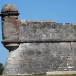 ST. AUGUSTINE: Coquina rock was likely formed about 2 million years ago (mostly from the tiny coquina clam we still see along the beaches today). As the resident clam died, the shells accumulated in layers forming deposits several feet thick. During the last ice age when sea levels dropped, the shell layers were exposed to the air and the elements. Over time, the exposed shell fragments became “glued” together into a porous type of limestone we now call coquina (Spanish for “tiny shell”). This pic is of a section of The Castillo de San Marcos, one of only two fortifications in the world (Fort Matanzas 14 miles south is the other) built out of coquina. It’s the oldest masonry fort in North America, and the only fort from the 17th century that is still standing. Now a National Monument, there are more than 20 acres here to explore and if you decide to check it out, the address is 1 S Castillo Dr., St Augustine, 32084.
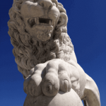 ST. AUGUSTINE: From HistoricCity.com we learned the Bridge of Lions was originally called the Matanzas River Bridge until 1928 when Dr. Andrew Anderson donated the two Italian Carrera marble lions sculpted by famed Romanelli studios and copied from the pair that guards the loggia Dei Lanze in Florence. Last year, a second set of lions were added to the opposite end of the bridge in celebration of St. Augustine’s 450th birthday. The new lions Pax y Peli (Latin for Peace & Happiness) are siblings to the existing lions Fiel y Firme (Latin for Faithful and Firm). The new lions were commissioned and donated by St. Augustine residents Wolfgang and Miki Schau. This pic was snapped of one of the older siblings on the West side (Historic Downtown) and if you want to come and check out the entire family, make your way near 1 S Castillo Dr., 32084.
ST. AUGUSTINE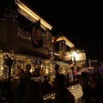 : Chosen by National Geographic as one of the ten best holiday lighting displays in the world, Nights of Lights in St. Augustine traces its origins back to the traditional Spanish practice of displaying white candles in windows during the Christmas holidays. According to VisitStAugustine.com, candles in the window allude to the fact that Mary and Joseph could find no inn that would give them shelter and when the Spanish put candles in their windows, they were symbolically making room in their homes and in their hearts. For more than 2 decades now, this 144-square-block historic district twinkles with millions of bulbs (each white) creating a stunningly beautiful cityscape. We shot this pic in front of the Tini Martini Bar at the historic Casablanca Inn and if you decide to make your way here too, head to 24 Avenida Menendez, 32084 before the end of January!
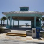 VILANO BEACH: In Vilano Beach on the first Saturday of every month from 4pm (3pm once Daylight Savings starts) until dusk, there’s a Sunset Celebration with music, performers, entertainment, local arts & crafts, vendors, and the opportunity to experience an extraordinary sunset from Vilano Beach Pier and Pavilion (across the bay from the City of St. Augustine). This is a pic of the entrance to the Vilano Beach Pier. The Sunset Celebration is free for all to attend and if you’re coming by land, here’s an address that will bring you very near the pier (254 Vilano Road, 32084). If you’re coming by water, there’s a floating dock with a 4-hour docking limit that adjoins the pier with a GREAT waterfront restaurant/bar called Beaches.
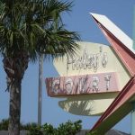 VILANO BEACH: Approximately two miles from St. Augustine and nestled between the Atlantic Ocean and the Tolomato River you’ll find the fantastic seaside community of Vilano Beach. Beginning in the late 1940’s and continuing in the 1950’s, small motels and “motor courts” emerged along Vilano Road. According to info we found on StAugustine.com, Newton Haley passed through Vilano Beach as a military man stationed nearby then came back after the war to settle here. Newt built most of the area’s mom-and-pop motels in the 40s & 50s and his holdings included Haley’s Court, noted for its unique signage. Pictured here, the hotel sign is today a historical marker and if you’re interested in checking out the great architecture and wonderful restaurants in this cozy seaside community, make your way near 150 Vilano Rd., 32084.
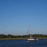
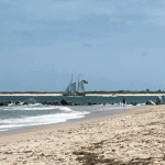 VILANO BEACH: According to VilanoBeachFL.com, when Henry Flagler brought northern tourists on his railway to his two luxury hotels in St. Augustine, The Ponce de Leon (now part of Flagler College) and The Alcazar (now the Lightner Museum), Vilano Beach was his guests’ oceanfront playground. Ferries brought vacationers about a half-mile over the Tolomato River to Vilano then connected there to horse drawn trolleys that delivered the wealthy visitors to the beach. Fortunately, we can explore this super laid-back beach town today with a lot less difficulty. By car, Vilano Beach is about two miles from St. Augustine via A1A or you can travel about a half-mile between the two points via water taxi @StAugWAXI. We shot this pic from Vilano Beach of this spectacular sailboat coming through the St. Augustine Inlet and if you decide to make your way here too, head to Vilano Beach Oceanfront Park near 10 Vilano Rd., 32084. Explorers’ Note: if you crave a bit of privacy, we suggest making a right when you hit the beach and make your way past the rock jetty.
CENTRAL (Begins in New Smyrna Beach)
 CAPE CANAVERAL/KENNEDY SPACE CENTER: From NASA.gov we learned that the Kennedy Space Center is located on 140,000 acres and is a melding of technology and nature. Wildlife thrives here alongside the immense steel-and-concrete structures of the nation’s major launch base. The Center is a national wildlife refuge and part of its coastal area is a national seashore. Archaeologists have uncovered burial mounds and shell refuse piles left by small bands of prehistoric Indians who inhabited the area thousands of years ago. There are more than 1,500 acres of citrus groves on the Center. These lands are leased to individuals who care for the trees and harvest their fruit. Beekeepers collect honey from and maintain the hives of bees essential to the pollination of citrus trees. The nerve center of Kennedy Space Center however is Launch Complex 39, the location of the Vehicle Assembly Building where the Saturn V vehicles were once prepared for launch and is now the NASA assembly site for the Space Shuttle. Quite possibly our favorite entrance of any location, we shot this pic in front of the Visitor Complex and if you decide to make your way here and explore, head to Kennedy Space Center Visitor Complex, SR 405, Kennedy Space Center, FL 32899. Explorers’ Note: We recommend setting aside a full day to explore this fantastical destination. While discount admission is available for military and seniors, standard admission is $50 for adults, $40 for children, and although it’s one of our pet peeves, there’s a $10 parking charge ($15 for RVs).
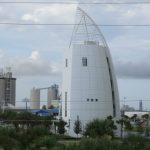 CAPE CANAVERAL: In Cape Canaveral, a stretch of Highway A1A is also known as Astronaut Boulevard and it was near here in 1969 at the Kennedy Space Center that the rocket carrying the first men to land on the moon was launched. Since that time, every human space flight launch in the US has taken place here. This is a pic of Cape Canaveral’s Exploration Tower where on the 7th floor you’ll find an outdoor observation deck with panoramic views of Port Canaveral and the Kennedy Space Center; a perfect place to watch the next shuttle/rocket launch. There’s a launch scheduled in both January and February and if you decide to make your way to Exploration Tower to watch it, the address is 670 Dave Nisbet Dr., 32920.
 COCOA BEACH: In 1962 the first US rocket Ranger IV landed on the moon; the average cost of a new house was $12,500; the average income per year was $5,556; the average monthly rent was $110; the tuition to Harvard University was $1,520; and the iconic Marvel superhero Spider-Man made his first appearance in the Amazing Fantasy #15 comic; also making its debut in 1962 – Cocoa Beach Pier. Here’s the address if you decide to come here and explore – 401 Meade Avenue, Cocoa Beach 32931.
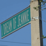 COCOA BEACH: In an effort to compete with the 1964 success of ABC’s “Bewitched”, NBC aired “I Dream of Jeannie” the following season. Starring Barbara Eden as Jeannie (a genie trapped in a bottle for 2000 years) and Larry Hagman as astronaut Captain/Major Anthony Nelson (who finds Jeannie’s bottle and ultimately releases her) the iconic hit series that ran for 139 episodes was set in Cocoa Beach and Cape Kennedy (actually filmed in California though). This is a pic of I Dream of Jeannie Lane named in honor of the TV classic and if you aren’t able to “blink” your way here to snap a pic, use the GPS address of 1500 N Atlantic Ave/A1A, 32931 (you’ll find the street sign and historical marker on the side of Lori Wilson Park).
 COCOA BEACH: We’re suckers for a good episode of Shark Tank and had the series existed 50 years ago, this entrepreneur would likely have made the cut. According to their website (RonJonSurfShop.com) the Ron Jon mystique started back in 1959 New Jersey when the company’s founder (Ron DiMenna) wanted a custom surfboard from California. His father suggested that his son, “Buy three, sell two at a profit, then yours will be free”, his Dad was right and Ron Jon Surf Shop was born; the first tiny location opened in 1961 on Long Beach Island, NJ. Two years later, Ron Jon “One of a Kind” Surf Shop opened in Cocoa Beach. It’s the largest surf shop in the world where you’ll find more than two acres of adrenaline pumping gear in a facility that’s open 24 hours a day, 365 days a year. And if you decide to come check out this A1A surfing mecca for yourself, the address is 4151 North Atlantic Ave., 32931.
 COCOA BEACH: Here’s a bit of history we found on WestgateDestinations.com; built in 1962 by local businessman Richard Stottler, the Cocoa Beach Pier is a historical landmark on the Space Coast. Stretching 800 feet over the Atlantic Ocean, the Pier (originally known as “Canaveral Pier”) was constructed with more than 2.5 miles of boardwalk planks, 270 pilings, each 40 feet in length and has undergone many changes over the years. Longtime residents can recall the days in the early 1960s when visitors could drive their cars right up onto the Pier itself. The Pier also offered a “grandstand seat” for Mercury, Apollo and Space Shuttle launches at nearby Cape Canaveral which was known as “Cape Kennedy” in honor of President John F. Kennedy between 1963 and 1973. And, as snacking our way across A1A is part & parcel of our explorations, there are a handful of dining options at the pier; this is a pic of perhaps the most convenient place to snack, Sea Dogs where you can also rent a volleyball, surfboard or body board and if you decide to make your way here, head to 401 Meade Ave., 32931.
 FORT PIERCE: Recipient of the City of Excellence and Great American Main Street Awards, Fort Pierce’s nickname is the Sunrise City (sister to the Sunset City – San Francisco). In addition to the spectacular sunrises and extraordinary beaches you’ll find here, the Downtown area is home to the A.E. Backus Museum & Gallery, the historic Sunrise Theatre, and the Original Tiki Bar & Restaurant. This pic of the harbor was taken from A1A/North Causeway and in the distant background you’ll see A1A/Seaway Drive; both cross over the Indian River and bring you to Fort Pierce’s historic Downtown or take them east and head toward the beaches! Either way, you may just find this charming A1A destination worth exploring.
FORT PIERCE: Modern-day Fort Pierce derived its name from the military installation constructed during the second Seminole War (1835-42) during which time the United States Army constructed military posts all over Florida including Fort Pierce. Named for Lt. Colonel Benjamin Kendrick Pierce (brother to the future 14th US President Franklin Pierce); Pierce and his troops constructed the Fort for the purpose of being a main supply depot during the War then abandoned it in 1842 when the war ended; the Fort burned down the following year. This pic was taken at legendary Archie’s Seabreeze; a wonderful old Florida style beach bar which has several bars and seating areas throughout and if you decide to come here and explore it, the address is 401 S Ocean Drive/A1A, 34949.
 FORT PIERCE: The Sunrise Theatre in Ft. Pierce is listed on the National Register of Historic Places and according to SunriseTheatre.com, the Sunrise opened its doors on August 1, 1923 as the largest theatre on Florida’s East Coast between Jacksonville and Miami. It quickly became the center of all St. Lucie County’s cultural activities. The theatre closed its doors on September 8, 1983, due to the decline of the downtown area and a refusal to convert to multi-screen operation. In 1988, Main Street Fort Pierce was established and soon realized the need for the Sunrise Theatre as a center for local, national and international world class performing arts presentations. We shot this pic in front of the theatre and if you decide to come here and explore this historic site, make your way to 117 South Second Street, 34950.
 HUTCHINSON ISLAND: is a narrow 23-mile barrier island bordered by the Atlantic Ocean on the east and the Indian River on the west creating an ideal habitat for more than 2,200 marine and wildlife species; 35 of these species are listed as threatened or endangered. This spectacular island can be accessed from the mainland via A1A through Fort Pierce on its northern end, and through Stuart on its southern end. This is a pic of Stuart’s beach – one of nearly 40 beaches you’ll find on the island, each with its own unique character. While you’re here, check out one of the permanent exhibits on display at the Elliott Museum called “Wheels of Change”. This exhibit includes a robot-controlled vehicle retrieval system (we’ve only ever seen something sort of like this in a NYC garage) that lets you pick one of the 50 or so classic vehicles housed there from the 3-story high stacked inventory. The vehicle gets pulled from the inventory and placed on a turntable so we can look/marvel at it; when we’re done with one, send it back to the inventory and choose another! Whether you choose to explore the museum or the beach (or both) the address 825 NE Ocean Blvd., 34996 will get you here.
 HUTCHINSON ISLAND/JENSEN BEACH: Extending roughly 22 miles from Ft. Pierce Inlet to St. Lucie Inlet you’ll find spectacularly beautiful Hutchinson Island. Hutchinson Island formed as a part of a chain of long, narrow and often low islands which comprise much of the coast of Florida and are known as “barrier islands”. This term stems from the fact that they form a “barrier” or “first line of defense” for the mainland against the high energy of the sea during severe storms and hurricanes. This pic was shot on Hutchinson Island’s Jensen Beach and if you decide to come and explore, here’s a GPS address you can use that will bring you near the entrance of Jensen Beach Park – 4191 NE Ocean Blvd, 34957.
 HUTCHINSON ISLAND/JENSEN BEACH: Bounded on the east by the Atlantic Ocean, on the south by the St. Lucie Inlet, on the west by the Indian River, and on the north by the Fort Pierce Inlet you’ll find extraordinary Hutchison Island and through it, runs one of our favorite stretches of A1A. Named after James Hutchinson, this barrier island was proclaimed Hutchinson Island in 1807 through a Spanish Land Grant. Much of the island is left as natural as the day it was when discovered, making it a wonderful sanctuary for wildlife and from April through September, Hutchinson Island becomes one of the most important nesting areas in the world for loggerhead turtles. Here you’ll find an abundance of public beach outlets and according to FloridasHutchinsonIsland.com, parking is free at all of them! Making your way toward the southern end of the island you’ll find spectacular Jensen Beach where we shot this pic and if you decide to come here and explore, head to Jensen Beach Park near 4300 NE Ocean Blvd./A1A, 34996. We couldn’t find a specific address for the park but the entrance is near the intersection of NE Ocean & NE Causeway Blvds.
 INDIALANTIC: Okay here’s a fun fact (we admit it, we’re easily amused) when a new word is created by fusing the sounds and meanings of other words (think smog: a combination of smoke and fog) it’s called a portmanteau; a blend of other words. The town of Indialantic’s name is also considered a portmanteau because its name was derived from a fusion of the town’s extraordinary location; between the Indian River Lagoon and the Atlantic Ocean (“India” and “lantic). This pic was taken on the spectacular “lantic” side! If you decide to come here and explore this beautiful beach, here’s an address to James Nance Park (public) that’s a great place to start – 201 N. Miramar Avenue, Indialantic, 32903.
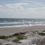 INDIALANTIC: From Mike Miller’s findings about early Floridians being “green” pioneers, we learned that in the time just before and after the beginning of the twentieth century, most Florida towns did not have electricity. Some parts of Florida however have natural artesian wells. These are wells that flow continually, bringing up water from the underlying aquifers like a miniature Old Faithful. Some early pioneers installed generators on the well heads and provided power for their own household needs. One such pioneer was Ernest Kouven-Hoven, the developer of Indialantic By The Sea (seldom used but official name) who had a house in what is now Indialantic that got its power from an artesian well generator. This is a pic of the spectacular Indialantic ocean-front and if you decide to come here and explore, here’s the address to James Nance Park public beach – 201 N Miramar Ave., 32903.
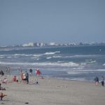 INDIALANTIC: From Indialantic.com we learned that the area’s recent history began in 1915 when Ernest Kouwen-Hoven moved to Melbourne and purchased a strip of beachside land lying between the Indian River and the Atlantic Ocean. He envisioned the property as an exclusive beachside resort and the one-square mile we now know as Indialantic emerged as “Indialantic-by-the-Sea” and was recorded as such on its first map in 1916. In the 1920’s rum-running off the coast of Indialantic was prevalent. It was during this time that the Indialantic Casino and the Indialantic Hotel were popular resorts hosting visitors from all over the world. Mary and Walter Hayward (we’ll need to do an entire story on this couple one day) are considered Indialantic Town Founders for their decades-long contributions to the Town’s culture and government from the 1930s until their deaths in 1993 (Walter) and 2007 (Mary). In 1975 by proclamation of a Town Council, Indialantic was designated a bird sanctuary and the Town has taken measures to protect both animal and plant species. Indialantic remains a natural, unspoiled paradise where threatened and endangered sea turtles nest along the shore from May through October. Both visitors and locals can enjoy the public beach area from Miami Avenue to Watson Drive where we shot this pic and if you decide to make your way here, you’ll find plenty of parking around 201 N Miramar Ave., 32903.
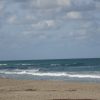 JENSEN BEACH: In an article published by Alice L. Luckhardt, we learned the history of Jensen Beach in the 19th century primarily revolved around pineapple farming. John Laurence Jensen, an immigrant from Denmark arrived in 1881 and set up his pineapple plantation. After only five years of production Jensen made $17,000 in pineapple profits (around a half million in today’s dollars). By 1895 more than a million boxes of pineapples were being shipped from the area during the June/July season. Although the industry would collapse by 1920, the legacy is still celebrated annually during the lively Jensen Beach Pineapple Festival. This is a pic of fantabulous Jensen Beach and if you decide to explore the area, here’s a beach address to get you started – 4191 NE Ocean Boulevard Jensen Beach, 34957.
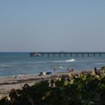 JUNO BEACH: When Greek and Roman mythologies get mixed in with a real life Game of Thrones, the story can get a little tricky but…according to a 30-year old article we found in the Palm Beach Post, when the Spaniards arrived in the 1500s to the area we now know as Jupiter/Jupiter Inlet Colony, they found a local Indian village called Hobe (pronounced ho-BAY). 200 years later when the English settlers arrived, they saw the name Hobe on the Spanish map and thought it was Spanish for Jove (the Latin name for the Greek god Zeus). The English, favoring the more common Latin name for Zeus (Jupiter), changed the town’s name in the 1700s from Hobe to Jupiter. When it came time to expand the Jupiter settlement, the sister settlement would be named for the god Jupiter’s wife, Juno. Here’s a pic of the Juno Beach Pier and if you decide to come and explore the area, the address for the pier is 14775 A1A, Juno Beach, 33408.
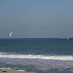 JUNO BEACH: Situated in Juno Beach between our favorite coastal highway A1A and US 1, you’ll find direct public beach access, free parking, picnic areas with grills, playground structures, and restroom facilities at family-friendly Loggerhead Park. Also located within the Park, you’ll find Loggerhead Marinelife Center a state-of-the-art full service veterinary hospital, exhibit hall, outdoor classroom, research lab, resource center, and admission here is always free (donations however are gratefully accepted). This pic was shot on spectacular Juno Beach and if you want to come here and explore the Park and/or the Center, make your way to 14200 U.S. Highway 1, 33408.
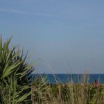 JUNO BEACH: Here’s one from GhostTowns.com. In an article submitted by Jim Pike we learned that the town of Juno was originally located about 3 miles south of current-day Juno Beach. Juno was the final stop on the Jupiter & Lake Worth Railway line and due to the presence of the railroad, Juno became the town seat of then Dade County. The town of Juno continued to grow as the railroad brought in a steady stream of passengers and income. Within a few short years however, Flagler’s new Florida East Coast Railway would put the Jupiter & Lake Worth Railway out of business and soon after, the once thriving town of Juno would be entirely abandoned. In 1899 a fire destroyed the deserted town leaving no remains of any of the original structures. This pic was shot on fantastical Juno Beach and if you decide to come here and explore, make your way toward 1219 Ocean Dr., 33408.
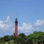
JUPITER: Dubbed “The Celestial Railroad” because its short 7.5 mile route passed through the way stations of Venus and Mars before arriving in Jupiter; this little railroad went out of business within 6 years due in part (according to jupiter.fl.us/history) because of the owners’ price-gouging efforts hauling lumber and supplies during the construction of Henry Flagler’s Royal Poinciana Hotel. Ultimately, Flagler bridged the Loxahatchee River and bypassed the railroad’s route in 1894 putting the railroad out of business the following year. This is a pic of the iconic red Jupiter Inlet Lighthouse and while we can no longer reach the lighthouse via “The Celestial Railroad”, we’re still able to explore it – the address is 500 Captian Armours Way, Jupiter 33469.
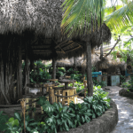 JUPITER: From Rivers.gov, we learned that while Florida has nearly 26,000 miles of river, there are only 2 rivers that have received the federal designation of “Wild & Scenic”; the Wekiva River (north of Orlando) and the Loxahatchee River which empties into the Atlantic Ocean through Jupiter Inlet. The Loxahatchee River has three main forks; the Northwest Fork of the river is the area designated as Wild & Scenic and while there are several places to explore the river via guided and self-guided tours, when hunger sets in you might want to try Guanabanas waterfront restaurant & bar. It sits on Lake Worth Creek which flows off of the Loxahatchee River and from its tropical setting to their house-made hot sauce, this place is just plain fun. If you decide to come here and check it out for yourself, make your way to 960 North Highway A1A, 33477.
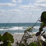 MELBOURNE BEACH: In 1883, Major Cyrus Graves began buying government land comprising present-day Melbourne Beach for the sum of $1.25 an acre. Bear in mind, no streets of any kind would be built for another 40 years so unless one was willing to hack their way through the brush, this extraordinary view of Melbourne Beach would likely have been masked to all except a determined few. And so to all the engineers and skilled laborers who have made it SO much easier for a majority of us to explore (without a machete); cheers and thank you! If you decide to make your way here to explore, find Ocean Park on Atlantic Street (near the corner of Ocean Avenue & A1A), Melbourne Beach, 32951.
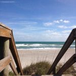 MELBOURNE BEACH: From multiple sources we learned that Juan Ponce de León was the first Westerner to reach Florida. Hearing tales of a wonderfully rich island called Bimini which was thought to be north of Cuba, Juan Ponce de León secured a commission in 1512 to conquer and colonize the land. On March 3, 1513 leaving Puerto Rico with three vessels, he sailed north west through the Bahamas sighting the Florida peninsula which he took to be an island. Probably because his arrival in Florida occurred at the time of the Easter feast (Pascua Florida), when Juan Ponce de León came ashore on April 2, 1513 he named the land which he claimed for Spain “La Florida”. This pic was taken on spectacular Melbourne Beach and if you want to make your way to the Ponce de León Landing, now a historical site, head to 4005 Highway A1A, 32951.
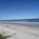 MELBOURNE BEACH/PARADISE BEACH: From MelbourneBeachFL.org we learned that during the winter of 1888-1889 present day Ocean Avenue, which runs east-west from the Atlantic Ocean to the Indian River, was first excavated and cleared by burning huge palmetto brush piles on the spot. A pier, nearly identical to the present day one was constructed and a railroad soon ran the length of Ocean Avenue and out onto the pier. The Melbourne and Atlantic Railroad, pointing straight as an arrow east and west along Ocean Avenue, ran one modest push-car. While it’s hard for us to wrap our brains around, at the time Melbourne Beach was the only access to the ocean for many miles in either direction unless you could hack your way through the brush as no streets of any kind were built on the island until incorporation in 1923. We shot this pic on spectacular Paradise Beach and if you want to make your way here and explore, head to 2301 N. Highway A1A, 32903.
NEW SMYRNA BEACH: Named by National Geographic Magazine as one of the “World’s Top 20 Surf Towns”, New Smyrna Beach is recognized as the second oldest city in Florida and one of the “Top 100 Small Art Towns” in the United States. This is a pic of the eastern end of Flagler Avenue (near Buenos Aires St.) leading to the ocean. All along Flagler Avenue (several side streets too) you’ll find a wide array of small shops, galleries, boutiques, and several places to eat, beach, and be merry. If you decide to make your way here and explore, here’s an address that will bring you near the heart of the action – 518 Flagler Avenue, New Smyrna Beach, 32169.
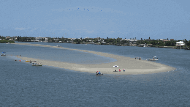 NEW SMYRNA BEACH: Ever wonder how New Smyrna Beach got its name? From FloridaMemory.com we learned that while the British only owned Florida for a brief period, they authorized generous land grants for citizens to step forward and colonize new territories. Dr. Andrew Turnbull, a Scotsman and a physician, convinced a number of his wealthy friends in Britain to take advantage of the land grants and start a new colony in East Florida. Turnbull planned to employ a number of Greeks from Asia Minor (in/near Turkey) and chose a Greek labor force because he felt they would be more accustomed to the warm climate they would encounter in Florida, because he believed he would be able to convince a good number of them to leave the Turkish Empire where he’d spent a number of years as a British consul, and because he had married the daughter of a Greek merchant at Smyrna in Greece. He named the colony New Smyrna in honor of his wife’s birthplace and the homeland of his future Greek labor force. The “Beach” part was added in 1947 when the city took over the seaside community of Coronado Beach. We took this pic in New Smyrna Beach from the SR44/A1A Causeway over the Indian River and wished we could have made our way out to that sandbar!
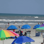 NEW SMYRNA BEACH: According to their website (NSBFLA.com) New Smyrna Beach was the largest British colonization attempt in the New World and was nearly three times larger than the first settlement at Jamestown in 1607. Though some historians believe it to be older than St. Augustine, New Smyrna Beach holds the distinction of being the second oldest city in Florida. Dr. Andrew Turnbull, a Scottish physician and entrepreneur, obtained a land grant from the British Crown and settled New Smyrna with an initial labor force of nearly 1,500 European immigrants. Turnbull named the area in honor of his wife whose birthplace was Smyrna, Asia Minor (what is now Izmir, Turkey). For thousands of years prior to the colonization, the area was inhabited by the Timucuan people whose civilization, like many other native populations, thrived until being destroyed by war and disease brought by European settlers. By the time Turnbull settled New Smyrna in 1768, the Timucuan population had nearly vanished leaving behind historical legends, artifacts, and more than two dozen historical sites to intrigue us. We shot this pic on spectacular New Smyrna Beach (the “Beach” part was added in 1947) and if you decide to come here and explore, head toward 518 Flagler Ave., 32169.
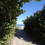 PARADISE BEACH: According to the City’s website (melbourneflorida.org) the area formerly known as “Crane Creek” became the “Village of Melbourne” on the morning of December 22, 1888. Credited with suggesting the Melbourne name was Mrs. R.W. Goode and although there is more than one version of how the naming was accomplished, it appears that straws representing various names were drawn and the “Melbourne” straw was the one drawn. This is a pic of the appropriately named Paradise Beach and if you decide to come here and explore it for yourself, the address is 113 Paradise Blvd, Melbourne, 32903.
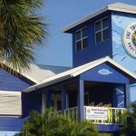 PORT SALERNO: A community with a history deeply rooted in the commercial fishing industry, today people are drawn to Port Salerno primarily for its restaurants, shops, and waterfront lifestyle. Honoring its fishing heritage and with attendance reaching nearly 40,000, every January Port Salerno hosts its annual Seafood Festival. Advance tickets are typically $5 and $10 at the Gate; children 12 & under are free. Due to the large crowds and number of children that attend, the Festival Committee requests attendees DO NOT bring dogs or other pets but DO bring a non-perishable food item to support the community food drive. This is a pic of The Twisted Tuna near the Gate 1 entrance of the Festival and if you decide to make your way here, here’s an address that will bring you close to the Gate – 4795 SE Dixie Hwy./A1A, 34997.
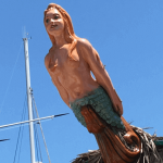 PORT SALERNO: Over a 72-year period, what town was renamed 4 times and had segments of the TV series “Gentle Ben” filmed there? Originally named “Alice” in 1894 by Florida East Coast Railway engineers to honor Henry Flagler’s second wife, Ida Alice Shourds; fifteen years later the town was renamed “Mulford” by developer Benjamin Mulford who renamed the town after himself. After being confused for Fulford, another stop on the FEC Railway, the name was again changed to “Salerno” for the many emigrant settlers of the area from the Italian city of Salerno. In 1960, area business leaders added “Port” to the name in an effort to highlight this waterfront area. This is a pic was taken on the fantabulous Port Salerno waterfront and if you decide to come here and check it out, here’s a gps address you can use – 4745 SE Desoto Ave, 34997.
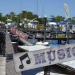 PORT SALERNO: Nestled on the scenic Manatee Pocket in the historic fishing village of Port Salerno you’ll find the fantabulous Port Salerno Waterfront District. As you stroll along the “PocketWalk” (the District’s boardwalk) you’ll find a dozen or so dining options, a handful of which are waterfront, and an artists’ community that’s home to resident artists where we’re invited to watch them create and purchase their unique works. Whether you arrive by boat or car, this stop is located on the site of one of the last operating commercial fish houses on Florida’s east coast and makes an A1A-mazing way to spend the day. We shot this pic near the Grove Dock Bar & Café and if you decide to come here and explore, make your way to 4745 SE Desoto Ave., 34997.
 SATELLITE BEACH: Incorporated in 1957 and named for its proximity to Cape Canaveral, Satellite Beach is a relatively new town by Florida standards. From Florida-Backroads-Travel.com we learned that Brevard County had a severe housing shortage in the 1950’s and 1960’s due to the rapid build-up of employment at Kennedy Space Center in support of the Apollo program designed to put a man on the moon by the end of the 1960’s. Satellite Beach became one of the residential communities built to handle this extreme demand. The land in Satellite Beach was originally covered in palmettos (palm trees) and oak scrub. Dredging of swampy land began in the 1950’s and many canals and some islands were created. Today, Satellite Beach is composed of nearly 3 square miles of land and more than one square mile of water where explorers can enjoy the Atlantic Ocean on the east and the Banana River on the west. We shot this pic near Pelican Beach Park and if you decide to make your way here too, head to 1525 Highway A1A, 32937.
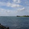
SEBASTIAN INLET: Sebastian Inlet is a man-made cut through the barrier island. This cut through connects the Atlantic Ocean with one of the most bio-diverse estuaries in the world, the Indian River Lagoon (we needed to look up the word ‘estuary’ – it’s where an ocean tide meets a river current). The Main Park Entrance and northern rec area address is 9700 South Highway A1A, Melbourne Beach, 32951. We chose to explore the southern rec area (it was WAY less crowded and equally stunning) if you want to get to the southern area, the address is 14251 Florida A1A, Vero Beach, 32963. Since it’s a State Park there are fees to get in; $8 for vehicles (up to 8 people), $4 individual (in a vehicle), $2 walkers/bicyclists, or buy an annual pass; any route you choose it’s quite a bargain for a truly memorable place to spend the day, with parking, concessions, and tidy restroom facilities!
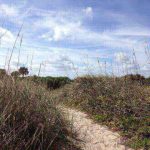 SEBASTIAN INLET: From sebastianinletdistrict.com we learned that in 1872, Captain David P. Gibson promoted a movement to dig an inlet on a strip of barrier island near present day Sebastian Inlet. At that time, the barrier island at the site of the proposed cut was approximately 260 feet wide. Six efforts to open the inlet took place from 1901 to 1915 with sand washing into the inlet as soon as it was excavated. A permit was issued by the War Department in April of 1918 and the seventh effort to open the inlet began. In 1924, the Sebastian Inlet was opened at its current location and small jetties were completed. In 1941 the Inlet closed due to a northeaster and for safety reasons, it was left closed during World War II, then permanently blasted open in 1947 and has remained open since. This pic was taken at the spectacular Sebastian Inlet State Park and if you decide to come here and explore, make your way to 9700 South Highway A1A, 32951.
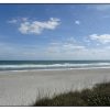 SPESSARD HOLLAND SOUTH BEACH PARK: For all those who responsibly enjoy beach cocktails, there’s a fantastic stretch of beach called Spessard Holland South Beach Park (there’s a North Beach Park too) where we verified via their website that adult beverages are actually permitted in designated areas – if you decide to check it out the address is 2545 Highway A1A, Melbourne Beach 32951; cheers!
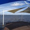
STUART: Stuart’s charming Historic Downtown makes our list of A1A favorite Sunday destinations because in addition to the eclectic group of small galleries, boutique shops, cafés, and restaurants, on Sundays there’s also a Green Market from 9a-1p (near City Hall) and from 1-4:00p there’s the Rock’n Riverwalk; a free open-air waterfront concert on the St. Lucie River. This is a pic of the Riverwalk stage and if you decide to make your way here and explore, you can use the address 61 W Osceola Street, 34994 to get you near the heart of the action.
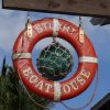 STUART: From cityofstuart.com & stuartmartinchamber.org we learned that when Stuart was first settled in 1870 it was originally named “Potsdam” in honor of the homeland (Potsdam, Germany) of the Stypman family, who owned what is now known as Downtown Stuart and who were among the area’s earliest settlers. In the 1880s, Homer Hine Stuart, Jr. purchased property and built a bungalow on the north side of the St. Lucie River. He donated land for a depot and in return, his surname was given to the railway stop when Henry Flagler brought his railway down the Florida east coast to Palm Beach. At the time, there was no vehicular bridge across the St. Lucie River and when general store owner Walter Kitching convinced Flagler officials to move the depot to a site in front of his general store, the name Stuart came to the south-side of the river with the depot. This pic was taken at the Stuart BoatHouse restaurant/bar which has outdoor seating and offers spectacular river views. If you decide to come here and explore the area, we’ve found luck parking near this address – 61 W Osceola St., 34994.
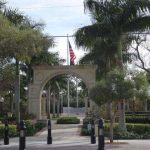 STUART: Located adjacent to the courthouse in downtown Stuart you’ll find fantabulous Memorial Park that hosts year-round events including a weekly Food Truck Invasion, a weekend green market, nautical flea market, ArtsFest, Bike Fest, and the Stuart Seafood Festival. Inside the park you’ll discover a magnificent banyan tree, pathways that are broad and paved, soothing water features, pavilions, concert band shell, racquetball, shuffleboard, and tennis courts and picnic tables. Yet perhaps the most memorable aspect for us were the memorials and plaques honoring military members of the Marines, Navy, Army, and Coast Guard. On Memorial Day, 2013, thirteen new war plaques were dedicated to honor those who have served in the various wars that have taken place throughout American History. We shot this pic at Memorial Park and if you decide to make your way here and explore, head to 300 SE Ocean Blvd., 34994. Explorers’ Note: The 30th Anniversary ArtsFest celebration will take place on Saturday (2/11) & Sunday (2/12).
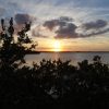 VERO BEACH: According to the World Almanac, Vero Beach is at the eastern end of the line that separates Florida’s climate into two zones; to the north, a subtropical climate and to the south, a tropical climate. This unique combination of climates produces an unusual mix of vegetation here blending ancient oak and pine forests typical of more northern regions with the palms and colorful blooms of the tropics. For this reason, Vero Beach is known as the “Gateway to the Tropics” and visitors make their way here (including us) again and again for its casual elegance and inherent natural beauty. We pulled off the road (A1A of course) to take this pic of the sunset over the Indian River in Vero Beach. If you decide to come here and explore, here’s an address that will bring you very close to Sexton Plaza Beach – 1050 Beachland Boulevard, Vero Beach, 32963.
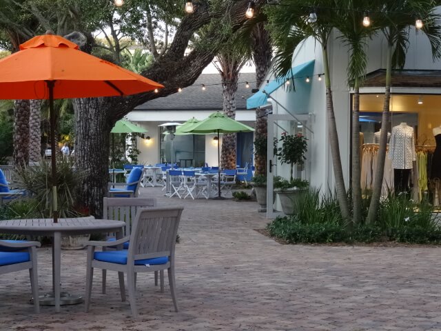
VERO BEACH – THE VILLAGE SHOPS: From USA Today we learned that the first group of settlers arrived in Vero Beach around 1840 however the urbanization of the area didn’t begin for another 75 years until after automobiles were being mass-produced in the US via the assembly line. When people could access the area more easily, vacation homes and resorts began dotting the beaches and Vero Beach’s reputation as a winter destination began. This pic was taken at the Village Shops a unique art, retail, and dining destination along our favorite highway and if you decide to come here and explore, the address is 6174 N Highway A1A, 32963.
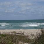 VERO BEACH: Many local history books were written long after the naming of a town had occurred which means much of the information typically comes from hearsay; it is in this spirit of the unconfirmed that we offer the following… From Indian River County Library we learned there are a dozen theories on where the name “Vero” came from and include Spanish, Portuguese, and Italian translations, East Coast Railroad controversy, postal edicts, even one that suggests the name was derived because hurricanes “veered” away from the area, yet the story most often attributed to the name’s origin comes from Sarah Gifford (wife of notable early settler Henry Gifford) who suggested the settlement be named for its Latin meaning, “to speak the truth” and while the library indicates this theory of her choosing a Latin word is reasonable and most likely, they also add that it would be interesting to understand why she felt Vero was a place for truth. It is certain however that in 1925 Vero’s name was officially changed to Vero Beach and this pic shot in spectacular Vero Beach is one of our favorites.
SOUTH (Begins near Palm Beaches)
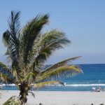 BOCA RATON: Pop quiz! Name one thing that Ariana Grande and the IBM PC have in common…If you need a little more time to finish guessing, don’t read on. If you’re already done guessing or just don’t want to guess, the answer we’re after is they were both born (about a decade apart) in a fabulous A1A destination; beautiful Boca Raton. This pic was taken in Boca Raton’s Red Reef Park and if you decide to come here and explore, the address for the park is 1400 N Ocean Blvd/A1A, 33432.
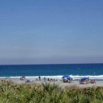 BOCA RATON: The meaning of the name Boca Raton has always aroused curiosity and in our efforts to explore the name’s origin, we found the following info on BocaHistory.org. Many people wrongly assign a literal Spanish to English translation of the name as a “Rat’s Mouth”. The Spanish word boca, or mouth, often describes an inlet, while raton means literally, mouse. The term Boca de Ratones or Boca Ratones, was a navigational term used when referring to a rocky or jagged inlet, but according to 18th century maps, the original location of Boca de Ratones was actually Biscayne Bay near present day Miami Beach. By the beginning of the 19th century, the term was mistakenly applied to the current Lake Boca Raton, whose inlet was closed throughout most of the 18th & 19th centuries. The “s” and later the “e” were dropped from this title by the 1920s, yet the correct pronunciation remains Rah-tone. We shot this pic near Red Reef Park and if you decide to come here and explore, make your way to 1400 N Ocean Blvd., 33432.
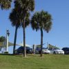
BOYNTON BEACH: David J. Castello wrote a great deal about the history of Boynton Beach and following is one of our favorite stories. In 1885 when the number of settlers in the area became large enough to warrant postal service, the stretch of Florida coastline between Palm Beach and Haulover Beach became known as the “Barefoot” Route and the postal carriers became known as the legendary “Barefoot Mailmen”. At the time there were no roads, no railroad, nothing that connected the two points except the coastline so with an overstuffed canvas mail sack slung over their shoulder, shirt and shoes off, schlepped eighty miles through the sand, in the blazing sun, for about $58 a month (around $1500 in today’s dollars). The round trip was 136 miles, eighty by foot, fifty-six by boat, and took 6 days to complete. In late 1892 the first county road here was completed and the following year the U.S. Postal Service did not renew the “Barefoot Mailmen’s” contracts. This is a pic of Boynton Beach’s Oceanfront Park near where the Barefoot Mailmen would have walked five coastline miles (every Monday) before resting in Delray Beach; if you decide to come and explore this strikingly beautiful area, the park address is 6415 N. Ocean Blvd/A1A, Boynton Beach, 33435.
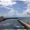 BOYNTON BEACH: According to info we found on BoyntonBeach.com, it was two years before Henry Flagler built his famous railroad that a former Civil War major from Port Huron, Michigan named Nathan S. Boynton first set eyes on the area that now bears his name. Boynton purchased 500 acres of land (at $25/acre) including a mile stretch of ocean frontage. He was so impressed by the natural beauty of what he saw he returned a year later with a group of colonists and built the famous Boynton Beach Hotel. When completed in 1897, the Boynton Beach Hotel consisted of a main building, an annex and five cottages that in total housed a hundred guests. By 1925, most of the hotel had been torn down to build a better one but between the devastation of the 1926 hurricane and the subsequent land bust it never happened. Today, all that remains of Boynton Beach’s most elegant landmark are two of its cottages. This pic was shot from A1A near Ocean Inlet Park and if you decide to come and check out this beautiful area, make your way to 6990 N Ocean Blvd./A1A, 33435 where you’ll find beach frontage, picnic areas, shelters, playground, restroom facilities, and plenty of parking. Great spot to simply chill…
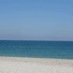 DANIA BEACH: Situated between Fort Lauderdale and Hollywood, the city we now know as Dania Beach originally began in 1898 as a settlement named Modello by pioneer and developer W.C. Valentine. Three years later, 30 Danes were recruited from Wisconsin to colonize the settlement and when the town incorporated in 1904, its 35 residents (most of whom were of Danish ancestry) changed the town’s name to Dania. In 1999, the city of Dania changed its name to Dania Beach and pictured here is its award winning “Blue Wave” certified beach which in our opinion, is one of the prettiest and least crowded stretches of oceanfront in the Greater Fort Lauderdale area. If you decide to come here and explore, here’s a beachfront address you can use for your GPS – 65 N Beach Rd, 33004.
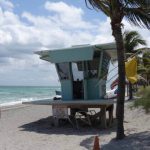 DANIA BEACH: In an article submitted by Jim Pike on ghosttowns.com, we learned that the town of Modello dates back to the 1880’s when much of Henry Flagler’s FEC railroad line was laid through the area. Modello is a contraction of Model Land Company, the business name of Flagler’s land sales division. Pioneer and developer W. C. Valentine planned out the settlement and Danish families from Chicago moved there in 1898-1899. When the Town was incorporated in November 1904, the residents, most of whom were Danes, changed the name to Dania. Early immigrants prospered in tomato farming and by 1910 the Florida East Coast Railway was shipping to northern U.S. cities from “The Tomato Capital of the World”. By 1912, Dania was a thriving community of almost 1200 people and continued to grow through the 1920’s when the City suffered tremendous setbacks. In 1925, the Dania Hotel caught fire, and the Bank of Dania failed due to embezzlers in the Bank’s home office. The 1926 hurricane with its 200 mile-per-hour winds devastated the Town, destroying most of the original buildings. The overwhelming damage prompted residents to vote for annexation to the neighboring City of Hollywood. Thus, Modello was no more. Later on the town reformed as Dania in its present form. This pic was taken on spectacular Dania Beach Ocean Park and if you decide to come here and explore, make your way to 100 N Beach Rd., 33004.
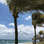 DANIA BEACH: Can you guess the connection between this pic and Led Zeppelin, David Bowie, The Doors, Santana, The Moody Blues, Jethro Tull, Deep Purple, Grand Funk Railroad, and the Grateful Dead? If you guessed the connection was Dania Beach, you’re right and here’s how. In the Spring of 1967, a pirate-themed amusement park called Pirates World opened in Dania (the Beach part came later) and in the late 60s and early 70s, this 100-acre theme park also served as a concert venue for some of rock’s biggest legends. While the park eventually closed in 1975, according to info we found on LostLiveDead.blogspot.com the Dead performed at Pirates World in the Spring of 1970 and spent some time that week sitting around the hotel pool; it was during those days they allegedly penned perhaps their most iconic song “Truckin” which they recorded a few months later and released on their American Beauty album in November of the same year. We shot this Dania Beach pic near Adler Park and if you decide to make your way here and channel a few classic rock vibes for yourself, head toward 65 N Beach Rd., 33004.
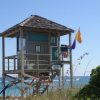
DEERFIELD BEACH: We found the following story on the Deerfield Beach Historical Society website – According to local pioneer, Molly Wiles Butler, there were two watch towers on Deerfield Beach to watch the coastline for Nazi boats and planes during WWII. Ms. Butler, her husband, her father J.B. Wiles, and others took turns manning the towers. They would call the offices at the Boca Club to report their sightings. Reports of Germans coming ashore from submarines off Palm Beach County have been controversial since World War II ended. This is a pic of the two-story towers that now appear on Deerfield Beach and while these towers continue to guard and save lives, from now on they will also serve to remind us how truly fortunate we are for their present-day function.
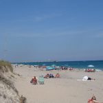 DEERFIELD BEACH: From DeerfieldBeachHistoricalSociety.com we learned that before the area became Deerfield Beach, it was called Deerfield and before it was called Deerfield, it was named Hillsborough (named after the Earl of Hillsborough) by C.E. Hunt, a Civil Engineer for Henry Flagler’s railroad. As the railroad continued to move south and the number of passengers increased, both local engineers and the train passengers on the railroad were struck by an abundance of deer as they passed by; as the reputation grew, the town’s name was changed to Deerfield. Before 1917, the only way to cross over the Hillsboro River/Intracoastal Waterway to the beach was by boat or to swim. Deerfield’s original bridge was a revolving structure with a wooden floor that was opened by a hand crank. The bridge could turn parallel to the shore allowing boats to pass. Once across the bridge, the road turned northeast and ended where the Deerfield Beach International Fishing Pier is today. If you look super hard you can see the Pier in the background of this pic snapped on Deerfield Beach and if you decide to come here and explore, the Pier address is 200 NE 21st Ave., 33441.
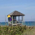 DEERFIELD BEACH: From deerfield-beach.com we learned that while the city’s non-native history began in 1877, it would be another 20 years before the first post office was established to serve the population of Deerfield’s 20 settlers. It is said the name was chosen because of the numerous deer that grazed along the Hillsboro River that formed the area’s northern boundary. By 1910, the intersection of today’s Hillsboro Boulevard and Dixie Highway was the focus of Deerfield’s businesses. At the time, Dixie Highway consisted of a nine-foot wide dirt trail and included a handful of stores, a lodge, the post office, and two hotels. The key to the area’s economy lay at the produce shed adjacent to the railway depot where farmers brought their vegetables and fruits there for shipment north. Gradually the community evolved from an economy based on agriculture to one based on tourism so much so, that by 1951 the word “Beach” was added to the city’s name. We shot this pic on spectacular Deerfield Beach and if you decide to make your way here and explore, head toward 105 S Ocean Way, 33441.
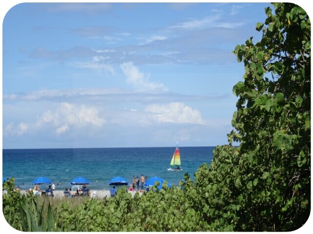 DELRAY BEACH: “My candle burns at both ends / It will not last the night / But ah, my foes, and oh, my friends / It gives a lovely light!” As relevant today as it was a century ago, this poem titled ‘First Fig’ originally appeared in the June 1918 edition of Poetry magazine. It was written by Pulitzer Prize-winning poet Edna St. Vincent Millay and according to BocaRatonNews.com, from 1935 to 1936 Millay rented a home in Delray Beach as a member of the city’s flourishing 1930s Artists and Writers Colony. Today, Delray Beach continues its legacy as a thriving artist community and while many things have changed since Millay walked the streets here, it’s likely this spectacular view has not.
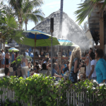 DELRAY BEACH: This is the Sandbar in Delray Beach. They’ve got a huge patio, a daily drink special (sometimes more), a few vegetarian options, and they’re directly across A1A from the beach. There are a couple of other choices in this same stretch (Caffe Luna Rosa, 50 Ocean, Boston’s on the Beach, BurgerFi) but in our opinion, the Sandbar has the best outdoor dining/patio. If you decide to check it out, the address is 40 S Ocean Blvd, Delray Beach, 33483 (near the corner of E Atlantic Avenue & A1A).
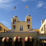 DELRAY BEACH: Ready for a ghost story? Here’s one we picked up from HauntedHouses.com. Built in 1926 by a father and son team, The Colony Hotel in Delray Beach has been from its conception a family-run business. Throughout the years when The Colony Hotel was closed during the summer season, people saw from the street odd activity happening inside the dark, empty hotel, especially after midnight. The police were called on many occasions. No one living was ever found inside the hotel. Still haunted? According to the site, the answer is a strong probably so. Through personal experiences of the people who have witnessed activity, it seems to be the home of several low key entities. Though some of it may be due to residual energy, a few intelligent spirits may still be enjoying the place, going about their eternal vacation or supervision of the staff in a low key manner. Not much proof is published on internet sites, though author Greg Jenkins in his book Florida’s Ghostly Legends and Haunted Folklore reports that amateur ghost hunters have caught whispering voices in EVPs (electronic voice phenomena) and had witnessed electromagnetic spikes during after-midnight investigations. We shot this pic of the fantabulous Colony Hotel and if you want to come here and explore it for yourself head to 525 E Atlantic Ave., 33483.
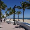 FORT LAUDERDALE: Fort Lauderdale’s public beach is one of the most famous in the world, one of the most visited in Florida, and one whose name became synonymous with spring-break vacations as a direct result of a motion picture release. In December 1960, MGM distributed the hit movie, “Where the Boys Are” a story about a group of Midwest girls who head to seek sun and fun in Fort Lauderdale. As a result of the film, the Spring of 1961 would bring the start of a decades-long run that brought hundreds of thousands of college-aged revelers each year to Fort Lauderdale beaches spilling over and blocking SR A1A for a month of steady drinking and other assorted amusements all inspired by the ’60s movie classic. If you decide to explore this iconic destination, here’s an address you can use to bring you near the heart of the action 241 S Fort Lauderdale Beach Blvd, 33316.
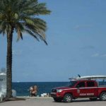 FORT LAUDERDALE: From FortLauderdale.gov we learned that the City of Fort Lauderdale has a rich history of continuous ocean lifesaving services dating back to 1926 and its Ocean Rescue is USLA (US Lifesaving Association) certified, nationally recognized for excellence, and supervises roughly three miles of continuous public beach from the South Beach Picnic Area up to and including the beach in front of Hugh Taylor Birch State Park. In the guarded areas of the beach, there are 20 year-round, permanently staffed lifeguard towers spaced between 200 and 400 yards apart. Drowning is very rare in lifeguard-supervised areas of Ft. Lauderdale Beach and through the site’s “Ocean Smart” Guide and “Ocean Smart” Kids Guide we found practical information about beach safety you may find useful too including floatation devices, leashing surf boards, and other useful suggestions to help keep us safe. We snapped this pic of one of Ocean Rescue’s badass 4×4 rescue vehicles and if you decide to come here and explore this beach, head toward E. Las Olas Blvd. & A1A, 33316.
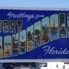 FORT LAUDERDALE: From time.com we learned the origins of spring break can be traced back to Fort Lauderdale and a 1938 collegiate swim competition that became a growing annual event. Over the next two decades, both the number of event participants and number of supporters continued to swell. TIME magazine first highlighted Fort Lauderdale’s spring break scene in an April 1959 article titled “Beer & the Beach”. Roughly two years later came the release of an epic spring break-themed hit movie called Where the Boys Are. The film, set in Fort Lauderdale, spread the tale of collegiate men and women voyaging to the peaceful shores of Florida to find fun, sun and maybe true love. By the free-loving ’70s, Fort Lauderdale’s fun and sun had become arguably raunchier. By 1985, some 370,000 students were annually descending on Fort Lauderdale and by the end of the ’80s, the town seemingly had had enough. Stricter laws against public drinking were put in place and the Mayor went so far as to go on ABC’s Good Morning America to tell students they were no longer welcome. As a result of this “encouragement’ to find an alternative playground and with the influence of MTV, spring break revelers descended on other Florida cities as well as destinations outside the U.S. where drinking ages were/are lower. Cheers to Florida’s original spring break town and if you decide to come and snap a pic near this roadside postcard, head toward 355 Florida A1A, 33316.
 HALLANDALE BEACH: In exploring the history of Hallandale Beach before the arrival of the first European settlers, we were introduced to the word “coontie”. Compelled to explore the word a bit further, we found a fascinating story by Susan Ford Collins on Flickr to share with you. Long before European settlers arrived in Florida, Native Americans used the coontie plant as a source of starch and the word itself comes from the Seminole meaning “bread” or “white root” because the roots can be made into flour. After being a money crop of the first Florida pioneers, the plant was nearly wiped out and with it, would likely have come the extinction of the iridescent blue and orange Atala Butterfly. Coontie plants contain a natural toxin which Atala larvae accumulate in their bodies and use to repel birds. Without coontie, adult Atalas have no place to lay eggs and no eggs, means no new generations. In an effort to preserve the colorful Atala, the coontie is being used increasingly in landscaping. And while we’re on the subject of color, here’s a pic of the super colorful Hallandale Beach Ball Water Tower and if you decide to make your way here to explore, head to North Beach City Park, E Hallandale Beach Blvd, 33009.
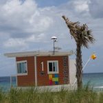 HALLANDALE BEACH: According to Seth Bramson’s book ‘Hallandale Beach Florida: For More than Ninety Years Broward County’s City of Choice’ the area we now know as Hallandale Beach was settled in the late 1800’s when Henry Flagler expanded the Florida East Coast Railway to Palm Beach. Realizing the value of the land to farmers, merchants and settlers, Flagler had James Ingraham (land commissioner for Flagler enterprises) work to increase “immigration” which at the time meant bringing in settlers from inside or outside America to Florida’s east coast. Ingraham then hired his brother-in-law Luther Halland to start a Swedish settlement south of the Danish settlement of Dania; the new settlement was to be named Halland in Luther’s honor. In 1898 Halland left the tiny village and upon his return to the area in 1911, was astounded by the town’s growth which had some years before had the letters “ale” added to its name. Hence, Hallandale began its rise to prominence; in August of 1999 the city officially changed its name to Hallandale Beach where this pic was shot and if you decide to come here and explore, make your way to 1870 S Ocean Dr., 33009.
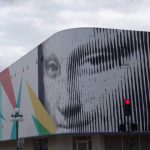 HOLLYWOOD: The Downtown Hollywood district is on the National Register of Historic Places and is the backdrop for year-round festivals, street markets, and entertainment. Here you’ll find quaint sidewalk cafés, brick-lined walks, and six blocks of unique boutiques, shops, art galleries with dozens of great restaurants all along Hollywood Blvd. & Harrison Street. There are also nearly two dozen murals that comprise the Downtown Hollywood Mural Project and you can either explore them on your own or join the free guided walking tour during ArtWalk on the third Saturday of every month. If decide to come and explore this fantastic pedestrian-friendly area, this link will take you to a great online resource available on the Visit Hollywood website.
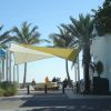
HOLLYWOOD BEACH: Founder Joseph Wesley Young, Jr. made the first purchases of land in 1920 from property owned by the Hollywood Land & Water Company and in 2015, the planned paradise Young named “Hollywood” celebrated its 90th Birthday. For more than 60 years, the Annual Hollywood Beach Candy Cane Parade rolls down the Hollywood Beach Broadwalk (between Missouri St. & Tyler St.). This is a pic from Polk St (one block north of Tyler) and if you decide to explore this area, use 298 N Surf Road, 33019 to make your way here. Bring a blanket, lawn chair or score a table and enjoy any one of the many wonderful seaside restaurants.
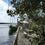 HOLLYWOOD BEACH: Here’s a haunt from BrowardPalmBeach.com where we learned the Hollywood Beach Resort Hotel was once known as the stomping grounds for Al Capone. The hotel is particularly known for paranormal and unexplained activities on the seventh floor. Reports of apparitions and ghostly orbs haunting that floor have run rampant for decades. There have been reports of disembodied voices calling out to guests, weird lights glowing from out of nowhere, and ghostly manifestations appearing. When one of our A1A adventures brought us to Hollywood Beach at 11pm, we decided to check in to this hotel and see if we could experience a haunting for ourselves. While we were in fact haunted during our stay, it definitely wasn’t the paranormal that will keep us from returning to this historic location (we’ll save that story for another day). We shot this pic at the nearby Le Tub Saloon where we happily pushed aside our lodging experience and enjoyed waterside snacks and cocktails in a funky-cool atmosphere on the Intracoastal Waterway; if you decide to come and check this place out, head to 1100 N Ocean Dr., 33019.
 LANTANA: The Town of Lantana is named for the genus Lantana, a family of perennial flowering plants native to tropical regions, including South Florida. According to The Coastal Star (thecoastalstar.com) in 1887, the Lyman family — considered to be Lantana’s founding family — arrived and built a home on what then became Lyman Point. This home is now the location of the Old Key Lime House restaurant you see pictured here and if you decide to come and explore this beautiful area and are looking for a place to start, here’s the address to the restaurant – 300 E Ocean Ave., 33462.
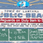 LANTANA: Although it is one of the smaller communities of Palm Beach County, Lantana is noted as one of the oldest. From LantanaLibrary.org we learned that the first settlers came to the area at the end of the Seminole Wars after Congress, in 1842, passed the Armed Occupation Act which was designed to encourage settlers to populate the Florida peninsula. One of the pioneer settlers, The Lyman family, is distinguished as the founders of the town. M. B. Lyman brought his family to Lantana in 1888 and started several enterprises. He established a store, Indian Trading Post, and post office in 1889. As postmaster, Mr. Lyman named the post office as Lantana Point for the wild Lantana plant that grew in abundance in the area. The ‘Point’ was later dropped. The Town of Lantana was incorporated in 1921 with twenty-two residents voting in the first election. At the time of incorporation, the area of Lantana was one square mile (roughly half the size it is today) with a population of 100 residents. We fell in love with this weathered sign we found along Lantana’s public beach and if you want to come here and explore, head to 100 North Ocean Boulevard, 33462.
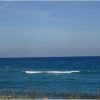
LAUDERDALE BY THE SEA: Coral reefs occupy less than one quarter of one percent of the planet’s marine environment, but are home to more than 25 percent of all fish species. Reefs are considered the most biologically-diverse marine eco-systems on earth and are rivaled only by the tropical rainforests on land. This pic was taken near Lauderdale-By-The-Sea’s Inside Reef, a living coral reef less than 100 yards from the shoreline and just south of Anglin Pier. Here, the reef is so close to the beach, it’s even accessible to snorkelers. If you decide to come here and explore, the address for the Pier is 2 Commercial Blvd, 33308.
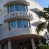 MIAMI BEACH: Miami Beach’s Art Deco District is the first 20th-century neighborhood to be recognized by the National Register of Historic Places. With 800 structures of historical significance most built between 1923 and 1943, these fantastic pastel buildings with porthole windows, ship-like railings, sleek curves, glass blocks, shiny chrome, and gleaming terrazzo floors are prime eye candy. This is a pic of the Deco District’s Essex House Hotel. Inside, above a curved fireplace, is an Earl LaPan faux-marble mural depicting the Everglades and although we weren’t entirely sure we’d truly found it, to the right of the lobby’s scagliola fireplace there’s allegedly a pattern in the terrazzo floor of an arrow that once pointed to a secret gambling room where gangster Al Capone and his gang are reputed to have “played cards”. If you decide to come and check it out for yourself, the address is 1001 Collins Avenue/A1A, 33139 and if you ever find Capone’s arrow, please share a pic of it with us!
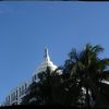
MIAMI BEACH: From MiamiNewTimes.com we learned that South Beach was reborn in Art Deco after the vicious hurricane of September 1926 claimed more than 400 lives and devastated the city. For the better part of the next two decades, Miami Beach saw a building boom that ushered in an era focused primarily on resurrecting the young resort community in the chic new style that had come out of the 1925 Paris Exposition Internationale des Artes Décoratifs et Industriels Modernes, which would be shortened simply to ‘Art Deco.’ With 800 structures of historical significance, the Art Deco District is the first 20th-century neighborhood to be recognized by the National Register of Historic Places. Guided and self-guided tours are available through the Welcome Center (mdpl.org) or just start strolling north on Collins/A1A from 5th Street through 17th. To snap this pic, make your way to 16th & Collins/A1A and look up!
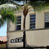
PALM BEACHES: Known as the “Rodeo Drive of the East Coast” shopping enthusiasts may find Worth Avenue in Palm Beach a veritable mecca. It’s been said that when the going gets tough, the tough go shopping and for those tough enough (you know who you are) the Worth Avenue Guided Walking Tour may be the perfect way to start exploring this celebrated shopping district. Every (non-holiday) Wednesday from the end of November through the end of April and lasting approximately one hour and fifteen minutes, the tours cover much of the history of Worth Avenue including its architectural importance, the influence on the fashion world and the development of the legendary social scene that established Palm Beach as America’s first resort destination during the gilded age. Meet your guide and fellow visitors at 11 a.m. at 256 Worth Avenue across from Tiffany & Co. and Chanel. The cost of the tour is $10 per person, no reservations, free two-hour parking along Worth Avenue or paid parking at Apollo parking lot behind Tiffany & Co.
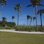 PALM BEACHES: Making its way from Havana to Barcelona with a cargo of 20,000+ coconuts, the ship “Providencia” shipwrecked off the coast of present-day Palm Beach and washed ashore in January, 1878. Prior to that time, the entire area we now know as Palm Beach, was known as Lake Worth. According to the Town’s website (townofpalmbeach.com) early settlers lost no time claiming the shipwreck’s salvage and planting the coconuts which were not native to South Florida. Fast forward fifteen years and the lush groves of coconut palms that had grown up following the shipwreck caught the eye of Henry Flagler who would fall in love with Palm Beach and the rest as they say, is history. This pic of meticulously placed coconut palms was shot from A1A and it’s one of the two championship golf courses you’ll find at Henry Flagler’s oceanfront resort The Breakers. If you decide to come and explore this extraordinary area, here’s the address – One South County Rd., 33480.
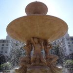 PALM BEACHES: Originally called the Palm Beach Inn, we learned from thebreakers.com that The Breakers hotel was built on the beachfront portion of Henry Flagler’s Royal Poinciana hotel. When many Royal Poinciana “regulars” began asking for rooms “down by the breakers” the name stuck and when Flagler doubled the size of his beachfront Inn in 1901, he renamed it The Breakers. In 1903 while workers were enlarging the building for the fourth time, The Breakers burned down. It burned down a second time in 1925 allegedly caused by a guest who left on her new-fangled electric curling iron. Refusing to be beaten by the catastrophe, Flagler’s heirs announced they would rebuild the world’s finest resort hotel on the site of The Breakers and, it would re-open within a year. More than 1,200 construction workers labored on The Breakers around-the-clock to meet the opening date and the immense Italian Renaissance structure was completed in just 11½ months. We shot this pic at The Breakers grand entrance and if you decide to make your way here too, head to 1 S County Rd., 33480.
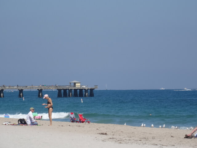 POMPANO BEACH: Mackerel-like in appearance, pompano is a type of fish abundant in warm Atlantic waters. According to PompanoHistory.com, local legend has it that the name for the settlement, “Pompano,” (the “Beach” part came later) came from a notation made on a survey map by Frank Sheen. Apparently while working here on a survey for the railroad, Sheen dined on the fish and was told the fish was “pompano,” Sheen notated the name on his map and Pompano became the name of the town. Whether or not the story is factually true, there is no alternate account of how the name came about. This pic was taken on the fantabulous public beach just south of the pier and if you decide to come here and explore, the address is 10 N Pompano Beach Blvd, 33062.
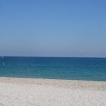 POMPANO BEACH: According to Pompanohistory.com, Pompano Beach is the second oldest city in Broward County and the fifth oldest in all of South Florida. Only Key West, West Palm Beach, Miami, and Dania Beach became municipalities earlier than Pompano (the “Beach” came later). Other than Key West, which by the 1820s was already an important port and city, the towns of southeast Florida came into being because of the railroad. In 1896 Henry Flagler decided to extend his Florida East Coast Railway south from West Palm Beach to Miami opening up land that had been a virtual wilderness. All along the rail line small settlements were established, most of them were farming communities. In 1908 when Pompano was incorporated, it was within Dade County. The following year Palm Beach County was created with its southern boundary being approximately at the Cypress Creek Canal. In 1915, Broward County was established with a northern boundary at the Hillsboro Canal which means that within eight years, Pompano had been in three counties. We shot this pic on magnificent Pompano Beach and if you decide to come here and explore, make your way to 10 N Pompano Beach Blvd., 33062 – Broward County!
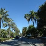 SUNNY ISLES BEACH: Approximately 10 miles north of Miami Beach nestled between the Atlantic Ocean and the Intracoastal Waterway you’ll find the City of Sunny Isles Beach; a 2.5-mile stretch of beautiful white sand and clear waters off Collins Avenue/A1A between 157th and 193rd streets. Unless you’re staying at one of the resorts here though, beach access/parking can be a bit of a challenge at first so we’re including a link to the city’s municipal parking info/map (http://www.sibfl.net/wp-content/uploads/2015/07/Parking-Map-4.6.14.pdf) that would have been super helpful to have in advance of our first trip. This is a pic of the fantastic tree-lined streets you’ll also find in parts of this casual and lively seaside community and if you’re looking for an address to get you started, here’s one for the Visitor Center – 18070 Collins Ave., 33160 (located on the 1st floor of the building).
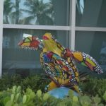 SURFSIDE: “3rd Thursdays” is this town’s free community block party which happens on the third Thursday of each month from January to April (7pm to 9 pm). This family friendly event takes place on 95th Street between Collins Ave (A1A going North) and Harding Ave (A1A going South) and is open to the public with no admission fee. Music, dancing, and fabulous food trucks; who could ask for anything more! This is a pic from “The Turtle Walk” a Surfside fun public art initiative that includes more than a dozen resin/fiberglass turtle sculptures each painted by a different South Florida artist and placed throughout the town mostly between 93rd and 95th Streets near A1A. If you decide to check it out the address of 9301 Collins Avenue, 33154 (Surfside Community Center) will get you near the heart of the action.
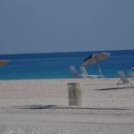 SURFSIDE: Nestled between Bal Harbour and Miami’s North Beach, there’s a one-mile stretch of fantastical oceanfront in a unique coastal community called Surfside. Here you’ll find walking and biking paths located along the shore in between the beach and sand dunes; a year-round outdoor public art installation called “Turtle Walk”; an eclectic mix of restaurants, bistros, and cafes; boutique shopping; and if you stay at a Surfside hotel, time share, or licensed condo rental, you have access to the Surfside Community Center and its recreational pool, children’s plunge pool & slide, whirlpool spa, and walk-up café. This pic was shot on Surfside’s spectacular beach and if you decide to come here and explore, you’ll find public parking at 94th & Harding; 95th & Collins; and 96th & Abbott, 33154.
THE KEYS (Begins in Key Largo)
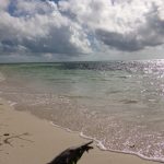 BAHIA HONDA KEY: About 45 minutes north of Key West and 15 minutes south of Marathon is perhaps one of the most spectacular beaches in all of Florida; the beach at Bahia Honda State Park. On the park’s 524 acres you can see more subtropical flowers than anywhere else in the Keys. The perimeter of the park is a tangled jungle of plants all carried here by sea birds, hurricanes, and ocean waves from the West Indies via the Caribbean Sea. The island itself is made of Key Largo limestone, derived from a coral reef similar to the present day reefs of the Keys. Several thousand years ago, a drop in the sea level exposed portions of the ancient reef, forming islands; Bahia Honda is the southernmost key where this formation is evident. This is a pic from our favorite spot and if you want to make your way here, once you get inside the park you have to make a right or a left, make a left then keep going through the back end of each parking lot until you can’t go any further. The park address is 36850 Overseas Hwy, Big Pine Key, 33043 – remember it’s a State Park so there will be a small entrance fee; we recommend an annual pass (good for 12 months from the time of purchase).
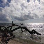 BAHIA HONDA KEY: Located between Mile Markers 36 & 37 you’ll find Bahia Honda State Park and its fabulous award-winning beaches. Calusa Beach (the smallest) is on the north side of the island and is adjacent to the historic and frequently photographed Bahia Honda Bridge. Loggerhead Beach (the most shallow) is located on the south side of the island and is known for its large sand bar that’s just a few feet from shore. Sandspur Beach (the largest) is located on the southeast end of the island and features a spectacular mile-long beach. There are more than 500 acres here to enjoy including a gift shop, snack bar, and kayak rentals. Beach wheelchairs are also available upon request at the Ranger Station. This pic was taken from extraordinary Sandspur Beach and if you decide to come visit our hands-down favorite Florida State Park, make your way to 36850 Overseas Highway, 33043.
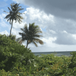 BAHIA HONDA: In an article by Erik Ransom & Dara Vance on GhostTowns.com, we learned that Pigeon Key, a small (less than 5 acres) island south of Marathon was named for the flocks of white-crowned pigeons that used to roost there. This tiny island played a huge role in the completion of Henry Flagler’s Overseas Railroad. Flagler was intent on extending his Florida East Coast Railroad southward beyond Miami to Key West. Pigeon Key, only 2.2 miles from the shores of Marathon, was an ideal location for creating a workman’s camp as the railroad bridge was completed. Although the conditions here were harsh, with no mosquito control, few trees for shade and of course, no air conditioning; during its prime construction years, the island housed up to 400 workmen in dormitories and tents. By 1908 the tracks ran as far south as Marathon and Flagler’s sights were set on crossing the 7-mile gap to Bahia Honda Key; by 1912, the railroad was completed. We shot this pic on the hauntingly beautiful Bahia Honda Key and if you decide to make your way here to explore, head toward 36850 Overseas Hwy, 33043.
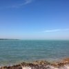 FAT DEER KEY: This pic was taken on Fat Deer Key, an island in the middle Florida Keys spanning approximately mile markers 53 through 56. Near mile marker 56 you’ll find the entrance to Curry Hammock State Park; the largest uninhabited parcel of land between Key Largo and Big Pine Key. The Park protects large areas of mangrove swamp, rockland hammocks and seagrass beds all essential to the Keys ecosystem and the shallow, protected waters make an ideal place to kayak and paddleboard, with a beautiful mangrove creek and miles of pristine coastline. If you decide to check it out, the address is 56200 Overseas Highway, 33050 and the entrance to the facilities is on the Oceanside.
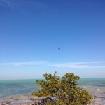 FAT DEER KEY: This pic was taken on Fat Deer Key, formerly the range of a deer peculiar to the Keys and once numerous on all the islands from Key West to Key Largo. Now endangered, the Key deer were hunted in and out of season until in an effort to save the deer from extinction, a 1939 legislative act was passed that prohibited hunters from shooting them. Nearly twenty years later when the Key deer population was at a low of 27, the National Key Deer Refuge was established designating roughly nine thousand acres on Big Pine Key for the protection and preservation of Key deer and other wildlife resources in the Keys. Thanks to this extraordinary measure, today the Key deer population has rebounded to roughly 800 and if you decide to come here and explore this remarkable area, the address for the Refuge’s Visitor Center is 179 Key Deer Blvd, 33043.
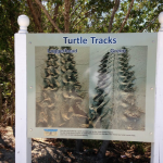 FAT DEER KEY: From Sea Turtle Conservancy (conserveturtles.org) we learned that unlike baby alligators, which are freed from their nest by their mother, sea turtle hatchlings must do it all themselves. To break open their shells, hatchlings use a temporary, sharp egg-tooth, called a “caruncle.” The caruncle is an extension of the upper jaw that falls off soon after birth. Digging out of the nest is a group effort that can take several days and once they decide to burst out, they erupt from the nest cavity as a group. The little turtles orient themselves to the brightest horizon, and then dash toward the sea. The obstacles are so numerous for baby turtles that only about one in 1,000 survives to adulthood. With nesting season once again upon us, remember it’s illegal to harm, harass or take sea turtles, their eggs and hatchlings, including getting too close to a nesting female and if you see anyone doing it, here’s the number for the FWC’s Wildlife Alert Hotline 888-404-3922 please take a minute now to add it to your cell. We took this pic on fabulous Fat Deer Key and thought it was a great illustration of the visual clues loggerheads and green turtles leave to alert us that nesting activity may be nearby.
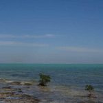 FAT DEER KEY: From Jerry Wilkinson’s research on KeysHistory.org we learned the origin of the term “Key” used to identify an island, is not well established. Although the Spanish normally used “isla” for island and “islet” for small island, in the New World they appear to use “cayo” and “cayuelo” for a very small island. Most believe Key is an adaptation of the Spanish word “cayo,’ used by the Taino Indians of Hispanola and Cuba. The English changed the word to “Cay” or “Kay.” Cay is pronounced by Americans as the letter “K,” but by Englishmen as the word ‘Key.’ English maps of the Keys made just prior to the Revolutionary War of 1776 used the word “Key.” Marathon is a 10-mile-long island community situated in the middle of the Florida Keys island chain and because of its location, is considered the heart of the Keys. It consists of many Keys one of which is the strikingly beautiful Fat Deer Key you see pictured here and if you want to come here and explore, you’ll find this Key located between mile markers 53.5 and 56.
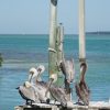
ISLAMORADA/LOWER MATECUMBE KEY: In one of Netflix’s binge-worthy series “Bloodline”, we get to explore the Rayburn family’s dark secrets and twisted past in a psychological thriller set in the Florida Keys (the central characters live on Islamorada). This is a pic from Robbie’s of Islamorada where the “Bloodline” characters have been filmed in boats and on the docks here. With open-air shops, water-front dining, a private sandy beach, boat rentals, snorkeling, and kayaking we put Robbie’s on our list of all-time Islamorada favorites. If you decide to check it out for yourself the address is 77522 Overseas Hwy., 33036.
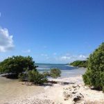 ISLAMORADA/LOWER MATECUMBE KEY: While some may recognize this extraordinary location from Netflix’s series “Bloodline”, Anne’s Beach in Lower Matecumbe Key was named in tribute of the contributions of long-time Keys resident Anne Kinder Eaton. A Vassar College graduate and stricken with polio at age 25, Kinder married multi-millionaire industrialist Cyrus Eaton in 1957 and together they travelled the world campaigning for world peace, women’s rights, racial equality, and the preservation of the natural and historic surroundings they so dearly loved. If you choose to come here and explore this spectacular destination, just make your way to MM 73 where you’ll find two parking lots approximately 1/4 mile apart; we suggest the more southern of the two lots and once you’re on the beach, head right.
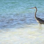 ISLAMORADA/LOWER MATECUMBE KEY: From Jerry Wilkinson’s extraordinary research on the Florida Keys, we learned that Florida East Cost Railway engineer William J. Krome surveyed various potential routes for the Overseas Extension from 1902 to 1904. While working for the railroad, Krome began taking time off to buy land and one of the pieces of land he purchased in 1907 was on Upper Matecumbe Key. On this land, Krome plotted the Townsite of Islamorada with 22 lots, hence the name Islamorada came into existence. Engineering acquaintances of Krome began to build homes on the bayside and the community of Islamorada was born. With time all of Upper Matecumbe became known as “Islamorada.” After Hurricane Donna in 1960, the name Matecumbe appears to have fallen into disuse. In a letter to Mal Flanders in 1965, Krome’s wife (Isabel Greenwood Burns) wrote, “I was not a member of the family at that time (they married in 1910) and had no part in the selection of the name, but Mr. Krome told me that it was derived from the Spanish isla (island) and morada, meaning home.” We shot this pic on spectacular Anne’s Beach and if you decide to make your way here and explore, head Oceanside near MM 73.5, Islamorada, 33036.
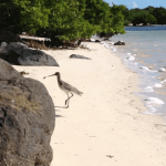 LOWER MATECUMBE KEY: From KeysHistory.org we learned that after WW-1, Congress approved the “Soldier’s Bonus” that would pay veterans (in 20 years or upon their death) a benefit. When the time came, each veteran was to receive $1 for every day served at home and $1.25 for days served overseas. The Great Depression came on in the late 1920’s and as the depression years continued, a new bill was introduced calling for the immediate release of the “Soldier’s Bonus”. To effect passage of the new bill, a few hundred jobless veterans from Oregon began a “Bonus March” across the country to Washington, D.C. and by June 1932 an estimated 20,000 jobless and homeless veterans were living in makeshift camps in the Capitol’s vicinity. The new bill however was dramatically defeated and ultimately General MacArthur would use troops to route the jobless and homeless veterans with tanks, tear gas and burned their makeshift camps. The public sympathy however was with the veterans and some say this incident gave Franklin D. Roosevelt an easier victory over President Hoover. As part of FDR’s New Deal economic program, one solution was to create projects that would provide employment opportunities; one of these projects would send jobless veterans to construct a bridge over the water gap between Lower Matecumbe Key and Jewfish Bush/Fiesta Key. We shot this pic on spectacular Lower Matecumbe Key and if you decide to make your way here, head toward mile marker 75 and start exporing!
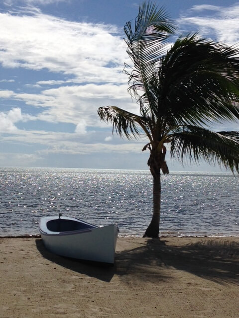 ISLAMORADA/UPPER MATECUMBE KEY: From KeysHistory.org we learned that Islamorada incorporated less than twenty years ago as “Islamorada, Village of Islands” and primarily consists of 7 islands; four separate and livable islands (Plantation Key, Windley Key, Upper Matecumbe Key, and Lower Matecumbe Key) two islands that are part of the Florida State Park system (Indian Key and Lignum Vitae Key) and one private island (Tea Table Key). This pic was taken Oceanside on spectacular Upper Matecumbe Key near mile marker 81 and while there is no public beach access here, you just may find the views from the Cheeca Lodge and Spa or the Moorings Village and Spa worth the splurge!
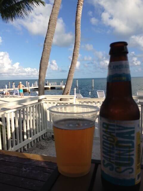 ISLAMORADA/UPPER MATECUMBE KEY: Islamorada has been called a drinking town with a fishing problem and if you decide to come here and explore, we recommend ordering local Islamorada Beer Company’s legendary craft beer “Sandbar Sunday” (we liked adding a key lime); if you want this particular view too, come to the patio bar at the Amara Cay, 80001 Overseas Hwy., 33036. Cheers to a Sandbar Sunday Funday!
 ISLAMORADA/UPPER MATECUMBE KEY: In a fascinating article by Jerry Wilkinson (keyshistory.org) we learned that like many other Keys’ names, the origin of the name Matecumbe is considered speculation. And while it is almost certain to be Spanish, some think it was derived from matar hombre (to kill man) because of the attacks on the Spaniards described in 1571 & 1573 while others believe that the island Achecambey described by Ponce de Leon in 1513 was the two Matecumbe islands (Upper & Lower) before being split apart. Over the years, its name has had many spelling variations and while there may be debate about the origin of its name as well as its spelling, there’s virtually no debate surrounding this Key’s spectacular beauty. This pic was taken on Upper Matecumbe Key near mile marker 80 and although there’s no public beach access here, aren’t we always just one rationalization away from finding a good (enough) reason to spend a little time in paradise?
 ISLAMORADA/UPPER MATECUMBE KEY: “We’re not bad people, but we did a bad thing.” This is the tagline of our favorite Netflix series called ‘Bloodline’ and if you haven’t seen Season 1, consider getting yourself to a TV for a little binge-watching before the May 27th release of Season 2 to get acquainted with the Rayburns; a family living in the Florida Keys with an intense secret that’s slowly destroying them. This is a pic of the Blue Charlotte House in the Moorings Village and the one used as the Rayburn family home in Season 1. According to their website (themooringsvillage.com) when the property is available it can be rented for $2,500/night.
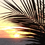 ISLAMORADA/UPPER MATECUMBE KEY: “Islamorada, Village of Islands” primarily consists of 7 islands; four separate and livable islands (Plantation Key, Windley Key, Upper Matecumbe Key, and Lower Matecumbe Key) two islands that are part of the Florida State Park system (Indian Key and Lignum Vitae Key) and one private island (Tea Table Key). We attempted to find the origin of the name Islamorada and although we never did, we found a few interesting theories… It’s all about color – some legends say the area was named by Spanish explorers who, seeing the purple sky at sunset and the purple bougainvillea, used the words “Isla” and “Morado” or purple island. Another source supporting the color theory was the purple glow came from the bioluminescence of the area’s Jellyfish. Still another theory is that the name has nothing to do with color at all. The early settlers came from the Bahamas and New England. They raised and shipped thousands of pineapples to northern markets. One of these ships was the “Island Home”, built on Plantation Key by Johnny Brush Pinder. It was from this schooner that Islamorada got its name “Isla Morada” or island home. This pic was taken at sunrise on Islamorada’s fantabulous Upper Matecumbe Key and while we couldn’t agree if color or home was a better theory, it was easy to agree the island is breathtakingly beautiful.
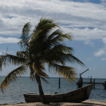 ISLAMORADA/UPPER MATECUMBE KEY: From John M. Goggin’s research on the history of the Matecumbe Region, we found that the Upper and Lower Matecumbe Keys and the nearby Tea Table, Indian, and Lignumvitae Keys have been an important focal point of human activity from very early times. Five archeological sites on these islands suggest that prehistoric peoples found the region suitable for living. More data on the early historic periods are available for this area than for any other region of the Keys; indicative of the area’s relative importance. The very name of the region, Matecumbe, is itself of much interest, as it is the only place name in South Florida which dates from the sixteenth century that is still used to designate the same or approximate location. The exact meaning of the name is unknown, but when the term Matecumbe first appeared in use in 1573, it was in a form very close to its present spelling and pronunciation. We shot this pic on spectacular Upper Matecumbe Key and if you decide to make your way here, head to Mile Markers 80-83 and start exploring!
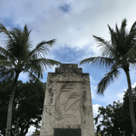 ISLAMORADA/UPPER MATECUMBE KEY: On Labor Day 1935, a killer hurricane with winds in excess of 200-mph, devastated the Matecumbe area of the Florida Keys. The heavy winds and turbulent seas sent a 17-foot tidal surge across the island killing hundreds of veterans and permanent residents. A rescue train sent from Miami reached Islamorada but was blown off the track by the force of the tidal surge. Dedicated in 1937 and placed on the National Register of Historic Places in 1995, the exact person who came up with the idea of the hurricane memorial is not known. From Jerry Wilkinson’s extraordinary content on keyshistory.org, we learned that the crypt made into the upper level of memorial contains the skeletal bones and cremated remains of many of those who perished. The native rock-covered obelisk of the memorial rises 18 feet above the platform and as we stood there looking up at the relief sculptured tidal wave and palms bending under the force of the terrific winds on the face of the monument, we were consumed by the thought of the enormity of the tidal surge that day (it would have been almost as tall as the monument), the hundreds of people who lost their lives, and extreme gratitude for all the technology that alerts us to get out of harm’s way. We couldn’t find an address for the monument but here’s the address for the Monroe County Public Library which is directly across the street – 81830 Overseas Hwy., 33036. Explorers’ Note: There are a couple of parking spaces on the east side of the monument.
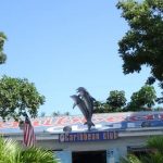 KEY LARGO: Key Largo gained significant island fame as the setting for the 1948 film “Key Largo”. It was the fourth and final film pairing of husband and wife screen legends Humphrey Bogart and Lauren Bacall. While most of the film was shot in Los Angeles, there were a few local landmarks that made their way on to the big screen; one of which is the Caribbean Club pictured here. Located near mile marker 105, we recommend taking your beverage of choice out back (the Long Island Iced Tea was delicious) to watch the extraordinary sunset. On our most recent visit they still didn’t accept credit cards so bring cash with you if you want to avoid an ATM fee. If you decide to check it out, the address is 104080 Overseas Hwy, 33037.
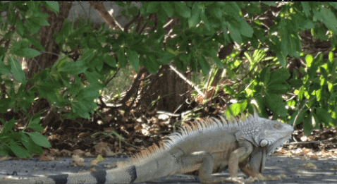 KEY LARGO/TAVENIER: For anyone seeing one for the first time, the wild green iguana can be quite a site. According to the Green Iguana Society, wild green iguanas in Florida are a mix of former pets and the offspring of these animals and, are generally thought not to be native to the United States. This places wild green iguanas in the category of “invasive” or “exotic” species — non-native species that have been introduced into a new habitat; most of which are believed to have come from the pet trade. While some people find wild green iguanas to be a beautiful addition to the Florida landscape, the fact is that at this time, they do not have a balanced place in the ecosystem with predators and competitors to keep their populations in check. This pic was taken in Tavernier from the back patio at Made 2 Order (fantastic breakfast by the way) and while the girth of this lizard’s midsection may not be evident in this photo, it was truly impressive and based on best guesstimate, it was no less than 4 feet long. If it’s still possible to think about food right now and you find yourself on the southern end of Key Largo hungry for an amazing breakfast, make your way to the back patio at Made 2 Order in Tavernier near mile marker 90.5 (Oceanside) 90691 Old Hwy., 33070.
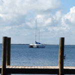 KEY LARGO/BLACKWATER SOUND: Originally called Cayo Largo (Long Island) by the Spanish, Key Largo is the largest and northernmost island of the Florida Keys and is roughly 70% larger than the next largest island in the Keys chain. The island is about 30 miles long and as a comparison in acreage, is similar in size to Manhattan Island, NY. Key Largo has the distinction of having the only living coral barrier reef in North America and includes roughly 190 square miles of coral reefs, 55 types of coral, seagrass beds, mangrove swamps, and more than 600 species of fish all of which attract underwater enthusiast from around the globe and contribute to this Key’s reputation as the “Diving Capital of the World”. This pic was shot on the island’s west side overlooking Blackwater Sound which offers one of the most magnificent sunsets we’ve ever seen and if you decide to make your way here too, head toward mile marker 104.
 KEY LARGO: One of the many things we love about the Netflix series ‘Bloodline’ is that it features real locations that fans (like us) can visit and if you enjoy that kind of thing too, this post is for you! Located just north of the Monroe County Road Toll Bridge on one of only two roads that motorists can leave or enter the Florida Keys, you’ll find Alabama Jacks, a funky waterside spot with strong cocktails, live music, and the occasional spirited entertainment (check out our YouTube post) and it was in this very location where Bloodline’s fictional Rayburn family’s oldest son Danny makes a stop before returning home for the 45th anniversary celebration of his parents’ hotel (Season 1, Episode 1, about 9 ½ minutes in). We shot this pic @ Alabama Jacks near North Key Largo and if you want to come and explore this lively hotspot for yourself, make your way to 58000 Card Sound Rd., 33030.
 KEY WEST: Opening in the 1920s, the historic Strand Theatre in Key West (now a drug store) is a Duval Street institution. It holds the distinction of being a movie theatre, then being used as a movie theatre when it was no longer a movie theatre in the 1993 film “Matinee” a comedy where a film promoter releases a horror film in the US during the Cuban Missile Crisis. Although its current interior may not have the charm it once held, the exterior is as romantic as ever and if you decide to check it out while you’re here, the address is 527 Duval Street, 33040.
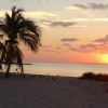 KEY WEST: From multiple sources we learned adventurer Ponce de Leon and his crew sailed toward Florida in search of the elusive Fountain of Youth; they never found the Fountain but in 1513 they did find the Florida Keys. There is no record that anyone from their ship came ashore on that trip however as his expedition sailed past the southernmost islands, his sailors saw the twisted, thick mangroves along the shores and named the islands Los Martires or “The Martyrs” because seen from a distance, the rocks appeared like men who were suffering. About a century later, the island we now know as Key West began to appear on European maps as Cayo Hueso which literally translates to “Island of Bones”. Here, it’s alleged the beaches were discovered to have been littered with sun-bleached human remains (bones) from prior battles or perhaps a burial ground. There is no authentic record of the origin of the name “Key West” however it’s generally accepted to be a corruption of the Spanish word Hueso (pronounced Way-so) that morphed into the word “West”. This pic was shot on Key West’s spectacular Smathers Beach and while it’s unlikely you’ll find any human remains here today, if you’re looking for a spot to experience the somewhat less photographed yet equally spectacular Key West sunRISE, make your way near 2601 S Roosevelt Blvd., 33040.
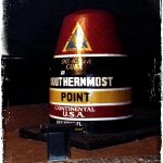 KEY WEST: Arguably the most photographed spot in Key West, this is a pic of the iconic Southernmost Point buoy. The location sprung up as a tourist attraction in the 1960s where visitors could purchase shells and sponges and decades ago, there was a large wooden sign here that read “The Southernmost Point of the Southernmost City Key West, FLA” which as one might imagine, became the subject of frequent thefts. We found two online sources (neither was Wikipedia) that allege the concrete buoy that became the permanent marker here in 1983, is actually a concrete sewer junction discovered during road work and painted to look like a buoy; we couldn’t get a confirmation (or denial) on that part of the story so it may or may not be true. Either way if you want to take a pic at this hot spot, make your way to the corner of South and Whitehead Streets or use 398 South Street, 33040 for your GPS.
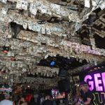 KEY WEST/WILLIE T’s: From FloridaMemory.com we learned that Virginia born William Pope DuVal became Florida’s first civilian chief executive serving as a territorial judge before being appointed governor of the Florida territory in 1822 by President James Monroe. DuVal’s administration was noted for its peaceful relations with Florida’s Indians and for the establishment of Tallahassee as the territorial capital. DuVal’s name is commemorated in a number of places around the state (usually without the capital “V”). Streets carrying the name Duval can be found in Jacksonville, Tallahassee, Key West, Pensacola, and many other towns and cities; Duval County was named for the governor in 1822. We shot this pic at the world famous Willie T’s Restaurant & Bar located in Key West on perhaps the most well-known and festive of the namesake streets where it’s estimated between 35 and 40,000 pieces of US currency decorate the interior. If you decide to come here and explore, make your way to 525 Duval St., 33040.
KEY WEST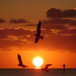 : Because our fear of clowns extends pretty much to dolls of any kind, our final October haunt comes from AtlasObscura.com and it’s about a doll named Robert. Something many agree to be true about Robert the Doll is that he’s terrifying; other things many believe to be true – the doll is haunted and has caused car accidents, broken bones, job loss, divorce and a host of other misfortunes. Robert is over 100 years old and now lives at the Fort East Martello Museum in Key West. Before that, Robert was the property of Robert Eugene Otto (the boy answered to the name “Gene”) and was a childhood birthday gift from Gene’s grandfather. According to legend, Gene began to blame mishaps on the doll. While this could have been laughed off as childish storytelling, adults also started noticing odd occurrences, especially as Gene grew older. In 1974 at the age of 73, Gene died and the doll had a new caretaker who said Robert would move around the house on his own, after twenty years of antics, she donated the doll to the museum in 1994 and since Robert arrived, visitors have flocked to the museum to get a look at the mischievous toy. He has appeared on TV shows, he has had his aura photographed, he is a stop on a ghost tour, and he’s inspired a horror movie. We shot this pic at sunrise on Roosevelt Blvd. about a mile away from the museum and if you want to go meet Robert face-to-face, make your way to 3501 S Roosevelt Blvd., 33040.
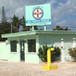 MARATHON/VACA KEY: Every year millions of us enjoy the abundance and natural beauty of Florida’s spectacular waters and coastlines. Regrettably, the ever-growing influx of our (human) activity has directly and negatively impacted the world’s sea turtle population. There are seven species of sea turtles throughout the entire world and five of the seven species are found in Florida. Located on the grounds of a former motel, this is a pic of The Turtle Hospital in Marathon, a fully functioning veterinary hospital with 23 individual tanks including a 100,000 gallon salt water pool. When you’re in the area stop by 2396 Overseas Highway, 33050 (near MM 48.5) and help support the hospital’s primary and critical mission to rescue and rehab sick and injured sea turtles so they can ultimately be released back into their natural habitat healthier and stronger than when they arrived.
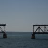
MARATHON: An engineering marvel of its day, the Old Seven Mile Bridge is listed on the National Register of Historic Places. Today you can walk or bike ride on certain sections (we wouldn’t recommend this section though) and if you come, there is parking off Mile Marker 47 in Marathon.
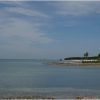
MARATHON/VACA KEY: Vaca Key is an island in the middle Florida Keys between Fat Deer Key and Knight’s Key and is located entirely within the borders of the city of Marathon. This is a pic taken on Sombrero Beach where you’ll find a wonderful small park, handicap accessibility, pavilions, volleyball, restrooms, and showers. It’s a turtle nesting beach (mostly Loggerheads) so please remember nesting season continues for about six months and runs through the end of October. If you’re coming, turn south on Sombrero Beach Road (near mile marker 50) and drive to the end or if you’d prefer an address for your GPS, we’ve used 2117 Sombrero Beach Road, Marathon (the beach is actually on the opposite side of the street but we’ve never been able to find a specific street address for it) this will get you in eye sight of the parking area though.
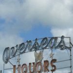 MARATHON/VACA KEY: According to the FloridaKeys.com website, the first historical mention of Key Vaca was its appearance on a Spanish map of the Keys in the 1500s. Vaca is the Spanish word for “cow” and it is thought that the island was named for the manatees or “sea cows” that lived in abundance there. The island remained sparsely inhabited until the arrival of Flagler’s railroad and the workers who came along with it enlarged the population and named their small town Marathon. Located on Vaca Key in the city of Marathon, this is a sign pic of the local area landmark Overseas Liquors (the liquor store & lounge are currently closed however) and if you decide to come here and explore this fabulous area, make your way toward mile marker 50.
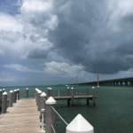 MARATHON: Iconic Seven Mile Bridge stretches out into the Florida Keys connecting Knight’s Key to Little Duck Key. At the time of its completion in 1982, it was the longest continuous concrete segmental bridge in the world, and is currently one of the longest bridges in America. Seven Mile Bridge actually consist of two bridges in the same location. The older bridge, originally known as the Knights Key-Pigeon Key-Moser Channel-Pacet Channel Bridge (rolls right off the tongue doesn’t it) was constructed from 1909-1912 as part of Henry Flagler’s Overseas Railroad. After the railroad sustained considerable damage during the Labor Day Hurricane of 1935, the bridge was refurbished for automobile use only. From 1978 to 1982, a new wider and sturdier Seven Mile Bridge was built right next to it. The total length of the new bridge is just under seven miles and is shorter than the original. We shot this pic in Marathon at the Sunset Grille & Raw Bar located at the northern end of the spectacular Seven Mile Bridge and if you decide to come here and explore, make your way to 7 Knights Key Blvd., 33050.
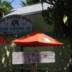 BIG PINE KEY: On Big Pine Key about a mile from No Name Key you’ll find the No Name Pub; a lively little honky-tonk that’s tucked away and in our opinion, worth the two-mile detour off A1A to try and find. According to their website, the history of the pub goes back to 1931 when it originally opened as a general store and bait and tackle shop. It remained that way until 1936 when the owners added a small room on to the main structure which became a restaurant and the Pub was born. In an effort to increase business, in the late 30s the upstairs storage room was converted into a brothel. In the 40s, the brothel closed and the beginning of the Keys landmark we know today began to emerge. By the mid-50s, the general store and bait and tackle shop closed and the Pub became 100% bar and restaurant and ‘No Name’ was added to the Pub’s name. In the 60s, their famous pizza was born and 50 years later, they still use the same recipe. Ice-cold beer and lively conversation in an old Florida Keys atmosphere make this 80+ year old landmark a great place to explore. We shot this pic on our last pub visit and if you decide to make your way here too, head to 30813 Watson Blvd., 33043. Explorers’ Note: we saw dozens of Key deer on our way to and from the Pub so if you’re going, please mind the speed limit and watch out for the deer!
 PIGEON KEY: On early Spanish charts, Pigeon Key was known as Cayo Paloma (dove or pigeon key). Most believe it was likely named after the Keys white-crowned pigeon that according to FloridaKeysBest.com, migrated to the area from Cuba. There was little use of the 5.31-acre island until Henry Flagler needed it to complete the Seven Mile Bridge and the island served as a base camp for workers during construction. From 1908 to 1912, more than 400 workers lived in the railroad village on Pigeon Key, which had a post office, commissary, and one-room school. Today, explorers can spend the entire day on the island exploring the fully restored turn-of-the-century buildings, soaking up subtropical sun on a picnic, and snorkeling the tidal shoreline. We shot this pic near Mile Marker 47 at the visitor center & gift shop located inside the railroad car where tickets can be purchased to access Pigeon Key by ferry. According to the local historian we met inside, this is an original railroad car from Flagler’s railroad that actually served as his personal dining car (the ceiling inside is super cool). If you decide to come here and explore, make your way to Crane Point Museum and Nature Center, 5550 Overseas Highway, 33050.
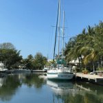 PLANTATION KEY: While digging into the history of Planation Key, FloridaMemory.com reminded us that the Keys stretch approximately 200 miles from Biscayne Bay near Miami to the Dry Tortugas. About 1,700 individual islands make up the Florida Keys which is a lot of breathtaking scenery to explore and an awful lot of islands to name and chart on a map. Many of the names contain a little gem of history about the islands they’re identifying and Plantation Key is no exception. The Florida Keys might not seem much like the place to have a plantation, yet that’s how this island got its name; the “Plantation” title likely stems from its use in coconut and pineapple production in the late 19th century. Located between Tavernier and Islamorada, this pic was shot on Planation Key near Tavernier Creek and if you want to come here and explore, head toward MM 90.
Have a new or vintage A1A inspired pic; share it here!
We’re thrilled to announce that we’re starting to partner with other travel sites to spread the word about A1A in other languages. It gives us great pleasure to share that our first collaboration will be with our friends @FloridaDePerto, a spectacular travel site!